While I am on the recent topic of the Half Dome climb in October 2005, thought I would add a couple of additional photos and tell a bit more of the story.

Chris and I decided we would go out and take on this hike as an alternative bachelor party for him, as his wedding approached later that month. We had prepared for the long hike over the course of the year, relying extensively on the Shenandoah Day Hikes book, which supplied us with four training routes in SNP, and Hiking Upward, a blog-style site that provides a pretty exhaustive review of more than 50 hikes in the Northern Virginia area.

So our hikes included Limberlost, Dark Hollow, and Hawksbill Summit, as well as the New River Falls, all in SNP. On one day, in fact, we hike the first three in succession. We also had an early climb of Sugarloaf in Maryland, and did a couple of the Knob hikes from Hiking Upward.
I figure our longest hike, crafted out of these excellent resources, would have been about 8 miles and included 2,000 feet of elevation.
Even though this kind of workout in the heat of August here in Virginia, went a long way to preparing me for the Half Dome climb, I could have used a bit more prep. And next time I will be sure to get it!
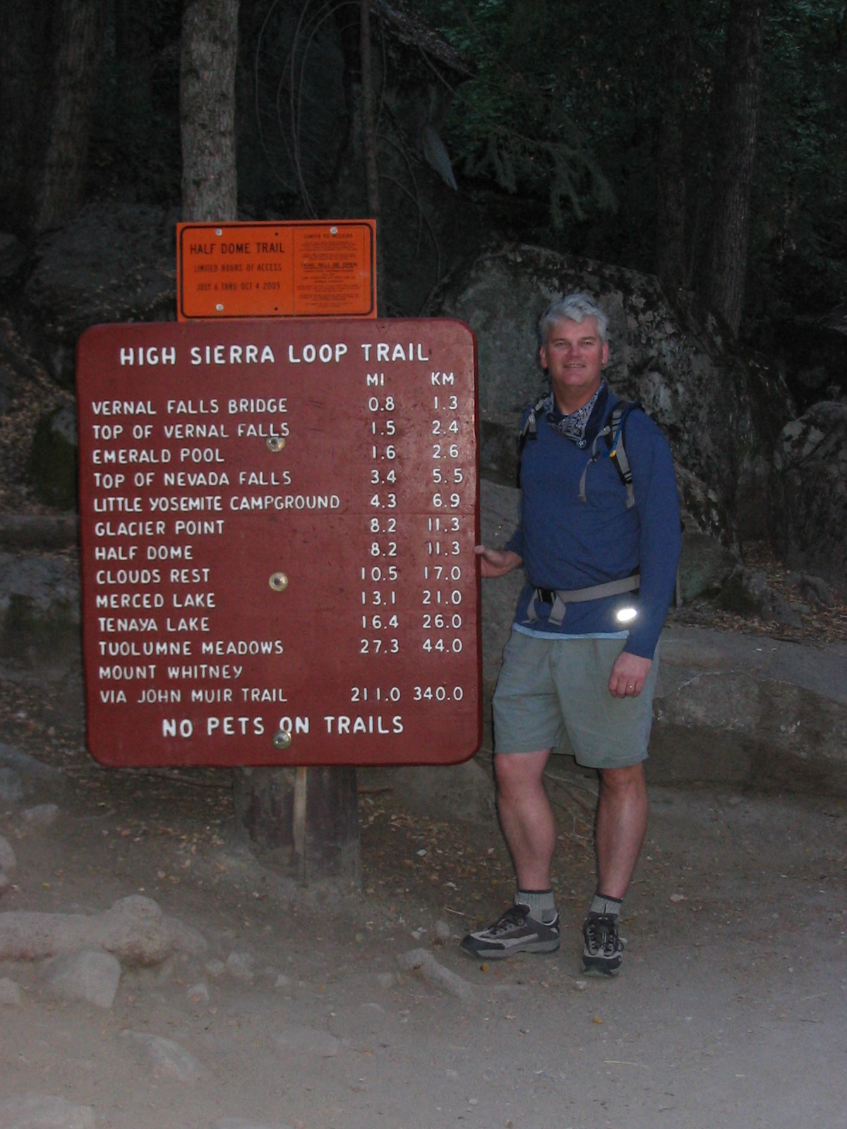
Now, more photos…the first two, above, are photos of me at the beginning of the hike – we started out while it was still dark. Folks who’ve visited Yosie will know that because of the depth of the valley, the light takes longer to get there – this photo was actually taken at around 7:30 am, something like two miles into the hike.

Second one is Chris at a stop we made at the top of the Nevada Falls. The trail leads up through the gap behind him, which goes to what is known as Little Yosemite Valley. There is a backpacking campground up there, available only during the Summer. At this point we were about ½ of the way through the outbound portion of the hike, and probably had covered somewhere between 1/3 to ½ of the total elevation change.
Also, there are two photos of the waterfalls that highlight the hike – the Vernal (317 feet) and Nevade (594 feet) Falls. These two falls are within a mile of each other…but it is a steep mile - almost 1,000 feet of elevation change!

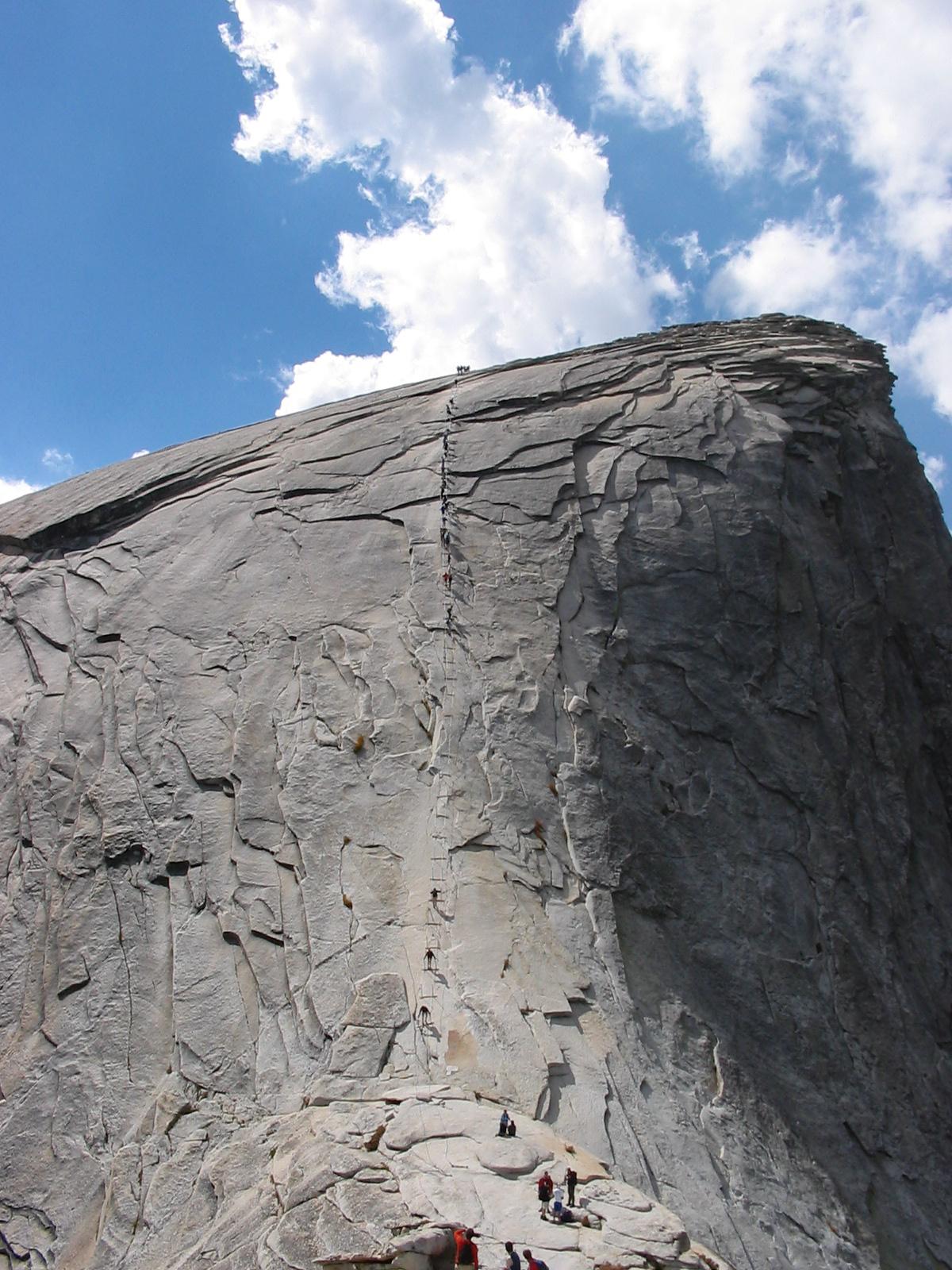
There is a fairly rigorous hike called the Mist Trail along the Merced River that takes you up to the Vernal Fall. One part of the trail, which walks along a cliff, is shown in the final photo. During the Ppring melt, these falls are really a show – have to admit I’ve only been to the park in the Fall season.

 Over the years I've put up a couple of posts about the Half Dome summit hike Chris and I did back in 2005, and then my return trip to Yosemite in 2010 - all labeled with the tag Half Dome, if you want to check them out. So, as the news about the fire in little Yosemite Valley has come out, naturally I'd follow it with interest.
  Here are a couple of photos I snagged from USA Today, which have apparently originated with Twitter users. If I knew the sources I'd credit them, but you can probably find the images on the web as well.