Ramble On

Showing posts with label Acadia National Park. Show all posts

Wednesday, June 29, 2016

The Gardens at Northeast Harbor


Our timing was good for the azaleas.
Our vacation time in Maine was coming to an end, so after all the hikes in Acadia National Park, we decided to take one last stroll around the gardens near our hotel, the Asticou Inn.  There are two - the azalea garden, which happened to be blooming just then, and the nearby terraced formal gardens called Thuya, a native American word for evergreens.  The gardens are administered by the Land and Garden Preserve of Mount Desert Island.

On our check-in day, Mary and I had taken a walk around the azaleas, which include a beatuiful pond and a zen garden.  While touring, we learned there was a moss garden that featured a toro, so checking that out became an immediate priority for me.


The traditional toro in the moss garden.
The source of my fascination with these lanterns stems from my visit to Japan in 2011.  After taking note of several that were on the base, and seeing even more beautiful examples of them on a shrine tour to Kamakura, I researched them to learn about the Buddhist cosmology represented by their structure (link here).

We found a docent in the gardens who took a break from pruning and weeding to lead us to both, as there is a second whimsical one near the pond.  I took a few minutes to settle in to enjoy them.  I continue to fancy the idea of getting one installed in the wood lot here at Hawksbill Cabin - certainly my thoughts dwelt on the possibility while we spent our time in the gardens in Northeast Harbor.

The whimsical toro near the pond.
On our last full day, after the morning hikes to the beach and the Bass Harbor Head lighthouse, we'd planned for a farm-to-table dinner at a new restaurant in town called Fork and Table (sorry, Facebook holdouts, but you will find them here).  While we were preparing for that adventure, we decided to take a walk over to the terraced formal gardens called Thuya Gardens.

The property is set apart by terraced stone staircases that switch back up the palisades to the old residence, passing plazas and pergolas on the way up.  There is a memorial to the designer, a summer resident of the place, named Joseph Henry Curtis.

At the top of the palisade, there is a leveled garden that will remind you of the formal estate gardens at Monticello or Dunbarton Oaks - with plantings done in the English style.  There are short staircases between the lawns that guide your pace as you take a pleasant walk.

It was a fine finish to our stay in Northeast Harbor and the Asticou.  It was a convincing argument for summering here in Maine on Mount Desert Island, but at last the time for us to go back to DC had come.

This is my final post in the Vacation 2016 series.  Soon enough - just as I had to get back to work at my day job, my posts here on the blog will return to status reports on the hop yards and the brewery in the works.  Those topics will be the basis of a busy July and August - so stay tuned!

Tuesday, June 28, 2016

The Last Hikes at Acadia

The Bass Harbor Head Light - view from the beach.
For our last day at Acadia, we decided to take a drive over to the west side of Mount Desert Island and put in a few more of the easy day hikes. Because the area was contested during the colonial era - the boundary of the French and English claims lay in the region, some features reference those struggles - the Man o' War trail is one of these, and it was something I wanted to check out.

We learned that Bass Harbor Head is also a small lighthouse on that side of the island, so we took that in, as well as a nice short hike along the seashore that we found by coincidence.

The pathway to view the lighthouse.
I decided to do a little bit of scrambling on the rocks down along the shoreline, looking for a good photography opportunity for the light.  To be honest, part of the reason for my scramble was to get away from another tourist on a cell phone, and a guy who was showing off for some of his family - quite loud, even over the sound of the surf.

Eventually I found a sheltered spot, and got my photo.  But there was also the treat of being able to hear a buoy nearby, once I got out of their voice range:


We had lunch after all that fun in the morning, and then drove around to find this Man o' War trail.  It's named for the fact that the colonial era fighting ships would send their crews ashore in the area to get drinking water.  That made for an interesting story to go check out.

We were still a bit sore from the climb along Champlain Ridge, so we decided to take a route to the little cascade that was the source of the colonial drinking water via a fire road.  It made things easier for us, since the circuitous, longer route featured a couple of hand-over-hand rock scrambles that we were not up for.

At the end of the fire road we found a little cascade tumbling over 10 feet or so.  Not much of a stream to speak of, but certainly there would have been something more to it after a rain.

The key to it all, standing there and having a look at it, was to imagine the challenges of going to sea that way and being on one of those ships for months at a time.  You weren't solely at the mercy of the environment during your voyage since at any time you might encounter the enemy and be blown out of the water in a battle.

That's a pretty intense way to live, even if you may not have signed on willingly.  I wonder how many modern Americans would be up for it.  That was good food for thought for the drive back to the hotel after the day's outing!

Monday, June 27, 2016

More Acadia Sites

The lovely shoreline at Thunder Hole.
One of the reasons we had bailed on the Champlain Ridge hike was due to the weather that seemed to be coming up.  The winds had picked up, and low-hanging gray clouds were moving in fast, so we were worried we might be caught on the trail in the rain, and headed in.

The rain never came in, but the wind was cold.  We got back to the car and decided to drive around the Acadia Loop Road and do some sightseeing as opportunities presented themselves.  We ended up making stops at Thunder Hole and Cadillac Mountain.

Thunder Hole is one of those spots on the shore where a canyon has been carved into the rocks, so that when the waves come in, and especially at tidal changes, you get amazing splashes and sound effects.  For the most part it was quiet during our visit there - which you can see in the iPhone video below:


It was mesmerizing, so we stayed and watched for a few minutes.  Other tourists came and went.  Once we got the hang of it, we ventured a little further down the trail to have a look at the grotto that was responsible for the splashes.  Here's a look from that angle:


Mary bundling up at the
Cadillac Mountain Summit.
Well, that didn't end well, as you can probably guess.  Now we were a bit wet - something we had tried to avoid by bailing on our hike.  But we still had an adventure left - Cadillac Mountain.

There is a road to the summit, with a parking area that reminded me of the one near Coit Tower in San Francisco.  I can imagine it being just as crowded on a summer day!

But we were there out of season, and the howling winds seemed to keep most of the tourist at bay.  We had a look around, seeking the summit - and were pointed in the wrong direction from the concession stand.  Wet and cold, we decided we were satisfied with "summiting the mountain" and headed back to the car.

When we arrived there, we saw some interpretive signs and other tourists nearby, and went to check that area out.  The views from this summit are worth the drive, or hike if you're up to it.

Apparently, Cadillac Mountain lays claim to being the first to see the light of day in the US for six months of the year.  That's the view you get - looking east across the bay to the ocean, which was gray and cold the day we went.

Still, the mountain is a must, and we had a good time up there checking it out - despite being wet from our visit at Thunder Hole!

Friday, June 24, 2016

The Champlain North Ridge Trail at Acadia National Park

As advertised, there were great views from the ridge.
After our cruise of the Cranberry Islands, topped off by lunch in Bar Harbor, I talked Mary into a second hike from the Best Easy Day Hikes - Acadia book.  Listed as a two mile hike that might take about two hours, it seemed within our capabilities, even though it was an ascent that would take us to the summit of Champlain Mountain.


The book describes the hike as follows:

"Enjoy expansive views from the summit of Champlain Mountain and all along the open ridge, the closest to the ocean of all of Acadia's ridges.  At times you'll see the contrast of fog rolling in over Frenchman Bay below and sun shining overhead, or storm clouds streaming in from the west as clear skies still prevail to the east."

An example of the Bates cairns at Acadia National Park.
We made our way up the trail, and it wasn't long before we began to note some interesting features:  the unique cairns that were established here to mark trails throughout the park, and wildflowers in bloom, including Colombine and Pink Lady Slippers.

The cairns have an interesting history.  Originally they were carefully designed by Waldron Bates and other locals on Mount Desert Island, who apparently felt they were stewards of the natural beauty of the place.  There's a link to an article here that provides a great overview of these features.


Pink Lady Slipper flowers at Acadia.


On the topic of wildflowers, I was particularly excited when we came upon this little group of Pink Lady Slippers.  It's a type of orchid that also blooms in Shenandoah National Park and the George Washington National Forest, where they even have an interpretive trail named after the flowers.  Try as I might, hiking extensively in April, May, and June, I have never managed to see one in Virginia - so it was a pleasant surprise to find them less than a quarter mile into our Champlain Mountain hike!

The trail follows rock ledges and forest trails on the way to the summit.  At times, it was a bit of a scramble, but no where near as difficult as Old Rag or Bear Fence in Shenandoah.  We made good time and found it easy going, for the most part.

Mary enjoying the hike - before the snake.
We did have two challenges on the trail, and at the end we weren't quite able to finish.


First, Mary ventured a little ways ahead of me and got out of sight.  It wasn't long before I heard a yell, "Snake!" - and there she was when I caught up.  I went to investigate to see a juvenile rat snake slithering calmly away - not an unfamiliar species, but a little surprising to see it here, on an island.


The second challenge happened further up the ridge. On this side of Mount Desert Island, the exposure is to the Atlantic, and the breezes were strong and cold.  During the afternoon clouds had been moving it, and it was getting cloudy and overcast, so when we emerged from one of the forest sections on the hike, we were suddenly cold and buffeted by some strong winds - enough for us to call it a day on this hike.

It had already been an adventuresome day, but we still had time to check out a few more sights before dinner.  We drove on around the park's loop road to Thunder Hole and Cadillac Mountain - and that's where my next post will pick up.

Wednesday, June 22, 2016

Shipping Out to the Cranberry Islands

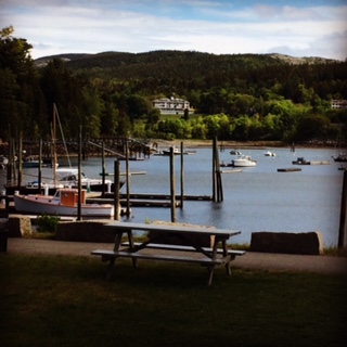
As we left Northeast Harbor, there was a view of
the Asticou Inn, where we stayed.
We had planned to take a day cruise in Maine - we'd heard about whale watching and the potential of having a look at a year-round colony of puffins.  While we were in the park the first day we learned that the National Park Service offered a cruise to the Cranberry Islands, which are just offshore of the larger Mount Desert Island where Acadia National Park is.

Bear Island Light - an early sight on the NPS cruise.
The fare is a bargain, and even better for us, the boat left from Northeast Harbor, a location within sight of the Asticou Inn where we were staying.  There is also a regular ferry to the islands, including Little Cranberry Island, which is the one our trip went to - the NPS operates a small museum with interpretive displays about island life there.

Our boat was crewed by a knowledgeable ranger who had been leading this tour for a few years.  On our cruise out, we made our way to the furthest of the islands.  There was something noteworthy to mention all along the way, including the Bear Island Lighthouse.


A second point of interest out in the harbor is a simple day marker that is built on a low lying island, no more than a pile of rocks.  Our boat approached and took shelter in the lee of the island - it was quite windy and there was a good chop going for the duration of our trip.

The daymarker - seals are visible as points of light
on the right.


Just to the west of the marker there lay a colony of gray seals, which partially explained why we had kept our distance from the island.  Maybe 50 of the animals lay sunning themselves, none disturbed by the nearby boat.
Our boat turned for our port-of-call at Little Cranberry Island, but not before we passed the location of a few osprey nests, and may have actually spied a nestling or two in one of them.  Eventually we arrived at the island, which is also known as Isleford, for an hourlong walk.

That was enough time to check out the storage yards around the harbor - several of the residents are lobstermen, and there was an exhibit in the little museum about island life, including the fishermen that live here.

Lobster pots and buoys stored for the season.
As our guide explained, in the past there were as many as 100 islands off the coast of Maine that hosted year-round residents, but now there are only 15.  Three of the islands are located here, near the park, including Mount Desert Island, Big Cranberry, and Little Cranberry Island.  

That was where my thoughts focused during the walk around the island - not only the challenges of living there during modern times, but especially how challenging it must have been during the early settlements, or even as recently as the last 50 years or so.

More lobster pots and buoys in storage.


As we made our way back to the harbor, Mary and I stopped into a pottery shop there.  The proprietor explained that she summered on the island, staying there from June until August.  She was just opening for the season when we stopped in - for the rest of the year she lives in Boston.

The chop on the harbor had gotten a little worse than when we first set out.  It wasn't so bad on the boat when we were underway, although docking at Little Cranberry took a second attempt.  We also were treated to the arrival of the mail boat, and a ferry arrival of folks arriving for the season, unloading all their luggage and groceries there on the little dock.

On the way back, our trip took us into Somes Sound, a glacier carved harbor that is similar to a fjord.  We were treated to a philosophical discussion of the technical definition of a fjord based on the Norwegian topography, and the result that this body of water has been downgraded in recent years because it is a relatively tame example of one of these features.

Our cruise over, Mary and I headed over to Bar Harbor for lunch.  Our first choice wasn't open, so after a walk around town we selected an Italian place near the water.  We fueled up, looking forward to a short hike we had planned for the afternoon, which will be the topic of my next post.

Tuesday, June 21, 2016

Hiking the Jordan Pond Path at Acadia

I'm a fan of these "Best Easy Day Hikes" books, and we got the one for Acadia National Park to help us plan our visit.  Since the inn wasn't ready for our early arrival, Mary and I went to the park for an orientation drive, and ended up having lunch at the Jordan Pond House - with the pond there inviting us, we decided we might go ahead and take a hike around it.

Jordan Pond, with the Bubbles.
From the easy day hikes book, the introduction to this trail says:

"The hike offers expansive views of Jordan Pond, the Bubbles, and Jordan Cliffs... . The graded gravel path on the east side of the pond is particularly easy, and an amazing 4,000 feet of log bridges on the west side helps smooth the way for what would otherwise be a potentially wet, rocky, and root-filled trail."

According to the "Map My Hike" app, this hike is just a bit over 4 miles long, although the book claims it is only around 3 miles long.  Otherwise, there's nothing to complain about in the description - it makes for a fascinating hike, and if you don't have time to do anything else in the park, it provides a good overview of the experience.

Intrepid day hikers on the Jordan Pond trail.
The pond itself is remarkably pristine, so much so that it is used for drinking water.  It's clear enough that you could see the bottom in most places.  The granite rocks that litter the south and eastern shore are moraines, as we learned, and the other significant trace of the glacial age are the two small mountains at the northeast end of the lake - the Bubbles.

Granite talus and birches.
One of the geologic facts I've learned since our hike is the composition of the stone were were seeing.  There is a shist formation of ancient seafloor, and then three varieties of igneous rock, including the Cadillac Granite, which are the pinkish boulders seen in many of the photos.  These colorful rocks, juxtaposed against the stark which birches, were one of the highlights of the Jordan Pond hike for me.

As we continued around the lake we would experience several other terrains, including the 4,000 linear feet of the log bridges, which are highlighted in one of the accompanying photos.  We hadn't read about how long this part of the trail was before we got to it - and remarked about how much of this boardwalk there was as we made our way along.  It's 5/6 of a mile, quite a structure!

An example of the mountains in the park.


We were lucky with the timing of our visit to the park.  There weren't a lot of tourists yet - apparently, since the summer season is so short here things can get very crowded.  As it was, we encountered only a few other hiking parties during our walk - everybody just as much in awe of the sights as we were.

And at 4+ miles, this hike was plenty to work off the lobster stew and Popovers(!) that we had enjoyed for lunch at the Jordan Pond House.  Later we learned that Popovers(!) are also a feature of dinner at the Asticou Inn - so we ended up having more!  But at least we'd had an excellent introduction to Acadia National Park already, by the time we checked in to our room.

Monday, June 20, 2016

Arriving at Mount Desert Island

One of many streams we encountered on
Mount Desert Island.
Our destination for the vacation was Acadia National Park in Maine.  We'd heard a lot about the park, famous for its glacial landscape and natural setting along the cold northeastern coast.  As soon as we arrived, before we actually crossed the last bridge to the island, we could see the mountains as they began to rise in the distance, and we knew we were visiting a special place.

We later learned about the French explorer Samuel Champlain, who came to the island to explore it in 1604.  According to Wikipedia, the journal entry he wrote about his observations include giving it a name:

"Le sommet de la plus part d’icelles est desgarny d’arbres parceque ce ne sont que roches. Je l’ay nommée l’Isle des Monts-déserts."  In Engish, "The mountain summits are all bare and rocky. I name it Isles des Monts Desert."

In our part of the country, we call these features "balds" - the bare granite at the top of the mountains won't hold topsoil or allow anything but the hardiest of plants to gain purchase.

The Jordan Pond House in Acadia National
Park is famous for "Popovers(!)"
Of course there is a long pre-colonial history to the place.  There is evidence of human activity dating back at least 6,000 years, and like Yosemite, the geology of the place was shaped by glaciers during the Ice Age.  The Wikipedia article says the glaciers retreated about 25,000 years ago, leaving moraines and other rocky deposits behind - we encountered these on some of the trails we explored.

Our room at the Asticou Inn was not ready for us when we arrived, so we went over to Acadia National Park to get our bearings for some of the touring we planned.  Our destination was Jordan Pond, based on a couple of recommendations from co-workers and others familiar with the park.

To our surprise and delight, the restaurant there at the pond was open for lunch and could seat us right away.  We sat outside, and while the actual season hadn't started, the place was bustling, and there were already interpretive activities going on there - a basket weaving demonstration and a nature walk, among others.

The incredible view from our room at the Asticou Inn.
We were offered "Popovers(!)" to start the meal, and to our surprise, there was already fresh local produce available for the salads and sides.  We chose a light lunch including lobster stew (this would be the only lobster I had during the trip - I'm not a fan, and prefer fish) and salads.

After lunch, Mary and I decided to hike around Jordan Pond - that will be the topic of my next post.  When we finished that, we headed back to the Asticou to check in - and we were welcomed to our room with an incredible view of Northeast Harbor.

Over the next few days, that mesmerizing view would entertain us with views of boats coming and going, and the tidal changes.  The Inn and the little town were a great choice for basing our trip - it could be a place we come back to over and over again, as is the John Dougherty House in Mendocino, Ca.