Ramble On

Showing posts with label Day Hikes: Moderate. Show all posts

Thursday, November 14, 2013

Prep for the Strickler Knob Reattempt

Chris and I had been in touch about the possibility of taking a hike sometime this fall, and we finally managed to pull it all together over Veterans Day weekend.  We'd contemplated several routes, including a second climb of Duncan Knob, climbing Kennedy Peak to enjoy the views overlooking the Luray Valley, or perhaps Marys Rock in Shenandoah National Park.  In the end, we decided that we would go back and tend to some unfinished business by completing the Strickler Knob route we had tried back in 2011.

As we often do, we used www.hikingupward.com as one of our guides for preparing for the hike.  It describes a 9.1 mile trail as follows:

"Some of the best vistas in the mid-Atlantic.  The new Strickler Knob trail is a challenging rock hopping/scramble that has beautiful views of New Market Gap, the Luray Valley, and a 360 picture perfect panorama from the Strickler Knob summit.  A nice hike with a great little rock scramble on the ridge."

We set about preparing logistics for the hike, with the goal of Chris staying over at Hawksbill Cabin the night before to shorten the time it would take to rendezvous and get to the trail head.  So we met on Friday night at the house, and were ready to head out by 9am - with a quick stop at Southern Kitchen in New Market on the way.  We were on the trail by 11am, which gave us six hours of daylight for this moderate hike, shortened from the Hiking Upward version - we would do approximately 5.4 miles, with an elevation gain of 800+ feet.

Google Earth image of our route to the Strickler Knob summit.
As I mentioned, this was not the first attempt at this hike.  We first tried in in January 2011, on a cold day with temperatures in the teens - I was still dealing with jet lag after returning from my trip to Japan the weekend before.  In the end, as we struggled, burdened with so many layers to fight off the cold while we climbed nearly 900 feet over the course of a mile and a half section of the longer hike, and we simply had to give up because we were running out of daylight.  The blog post about that failed attempt is here:
http://hawksbillcabin.blogspot.com/2011/02/strickler-knob-moderate-and-incomplete.html

I had promised myself I would make another go of this one, and was glad that Chris agreed to try it.  I'll post about the trail tomorrow.


Friday, September 23, 2011

Wildcat Ridge/RipRap Hollow: A "75 at 75" Hike


The famous swimming hole.
 For the sixth hike in my “75 at 75” project (check that label below for more details on the project), I chose the big loop at RipRap Hollow and Wildcat Ridge. In the introductory post on the project, I summarized the trail, drawing from Henry Heatwole’s guide, as follows:


Rocky formations in the hollow.
 “Riprap Hollow and Wildcat Ridge: mile post 90.0, 9.8 miles and 2,400 feet; includes the two Civil War lookout points Chimney Rock and Cavalry Rock, 3 miles of AT section, cascades and a falls.”

Early on, as I began thinking about the project itself, I mentioned it to my neighbors Dan and Sally, who both thought it was a great idea. They both work at the Park, and they’ve been generous with insights and inspiration about the place over the years. When I mentioned this trail, Dan was particularly interested and he ended up joining me.

Apparently, in his job as a GIS specialist, there were some details of the trail he wanted to check out better on his own – he’d done the one-way trail from the RipRap trailhead to Wildcat before, without the AT section; some colleagues had subsequently done the whole thing and given him some hints on things to look for. In any case, Dan being the only person I know who has walked every foot of Skyline Drive, I knew I was in for some interesting insights on this trail, and I hope that he (and Sally too) might be able to join me again on another of the hikes.


Here's a Google Earth view of the trail, with a fine blue line marking our GPS trace.
 We left our neighborhood at 8am and made our way via the Elkton entry to the Park, arriving at the trailhead at around 9am. This was something new for me…even though the Heatwole guide lists the route as taking 8.5 hours, it was very likely that we would complete the trail before darkness (for my regular hiking buddies, I kid because I love). We began the steady descent on Wildcat Ridge by 9:15.

Neighbor Dan down in the hollow.
I’d hypothesized that the name of this trail section had something to do with earlier residents seeing bobcats, or even pumas, here; or else, it was a reference to mining activities that had taken place nearby at Crimora (there are a couple of lakes there that were associated with manganese mining in the late 1800s). Shortly we came upon a series of small pits just off the trail, about 10 feet by 10 feet each, and up to six feet deep. The holes were enough to convince me that name’s origin referenced the mining industry, that the “wildcats” were people doing exploratory digs up here hoping to strike it rich; Dan has subsequently confirmed that there are some records of this type of activity in the area.

We went onward, finally reaching the hollow, where our destination was the swimming hole down here. Heatwole calls this the largest in the Park. The swimming hole is 50 feet or so in diameter, and during our visit, it probably reached depths of six feet. The water is crystal clear and spring fed, so too cold for a dip in mid-September. Instead we settled in for lunch.

While a couple of other hiking parties came and went, we broke out our lunches…Dan’s was much better than mine: moose sausage snack sticks and smoked salmon that he had acquired from an Alaskan friend during a recent trip out west. He invited me to share, supplementing my Clif Bar and raisins; I did pass along a Honey Stinger Waffle in exchange for his generosity.

There are a couple of mentions of an old picnic shelter near the pool. It’s been taken down, but the areas around the pool show a lot of wear and tear – this is a popular place during the summer, and it is near the Park boundary, so there is a convenient hike-in route.


Old beams in the stream.

Old masonry and more beams.
Making our way through the hollow, Dan finally gave me a little more insight as to why he was so interested in this trail. While the popular references I had drawn from for the hike have very limited information about the cultural aspects of the area, mainly because of few indications of post-Columbian activity here (the exploratory pits on Wildcat Ridge aren’t even well documented), a colleague of his had identified a trace in the stream where there are remnants of what appears to be an old sawmill.

We found the spot and made a short detour down to the stream edge. I have some photos of old beams in the streambed, and some masonry joined to the rocky cliffs that line the stream. As we looked, I tried to imagine what the work here would have been like, a few miles into the woods, a long track to the nearby mining activities. Not much of a challenge to hardworking mountain people, but pretty difficult for my “chairborne” lifestyle!

Me at a less crowded view point.
As we got back to the trail we headed next for Calvary and Chimney Rocks, two quartzite outcroppings that offer wonderful views of the Shenandoah Valley. The walk along this section of our route was interesting; Dan told me that during the summer of his arrival at Shenandoah National Park, this area had been in a fire and it was his first ever support of that kind of an effort. The hillside is still recovering with low, scrubby vegetation and numerous young pines (the variety in this area produces serotinous cones, which release the seeds after a fire).

Upon reaching the two viewpoints we found them crowded with visitors sitting on ledges and enjoying the look out over Paine Run Hollow and Horsehead Mountain, so we didn’t stay long. We continued on to the AT connection and did that 3 mile stretch back to our parking area; we were passed on the way by a south bound thru hiker, who’d been held up in the rains and tropical storms of late. “Beautiful day, much better than last week!” he offered as he passed us by.

We finished the route in about 7.5 hours, making better time than Heatwole’s estimate. After a quick chat with the ranger at the Elkton gateway, we headed on to Mamma Mia’s in Shenandoah for dinner, before heading home.

Wednesday, September 21, 2011

Doyles River/Jones Run: A "75 @ 75" Hike

Jones Run Waterfall - 42 feet.
Knowing that I had a big hike planned for the upcoming Saturday, and because I’d planned to take that hike with neighbor Dan, who not only recently had completed a half marathon and is a GIS specialist at the Park, but also is one of the few people on the planet who has walked every footstep of Skyline Drive, I went looking for a warm-up hike on Wednesday, September 7. I chose the Doyles River/Jones Run combination because of its length and elevation, and because all of the waterfalls on that trail would give an interesting destination. Incidentally, I’ve hike the entire circuit of this trail before, you can find it under the “Day Hikes: Moderate” label.


Google Earth route for this hike.
When I do warm-up hikes like this, they don’t necessarily have to meet the rigorous qualifications I’ve set for “75 @ 75” hikes, although this one, at 5.8 miles and 1,120 total elevation gain, certainly met the requirement (a combination of at least five miles in length and 500 feet of net elevation gain). I thought that two days of rest between the warm-up and the actual hike would be enough, but my legs still stung from the lactic acid on Saturday morning as we made our way to the Wildcat Ridge trailhead for the main hike – which I’ll review later this week.

Before getting to the details of this one, I want to make a note about how I calculated elevation on this one. Normally, I’ll just take an altimeter reading on my Casio Pathfinder along the way of any given hike, catching the highest and the lowest point s. When I make the blog post about that hike, I simply subtract the lowest from the highest for net elevation, and that’s what I report – which typically will vary, for several reasons, including barometric pressure variations or the fact I don’t count “pointless ups and downs,” or PUDS, in my calculations.

Casio Pathfinder check point.
Elevation reference point.

In this case, I knew I was in for a descent from the trailhead down to the confluence of Doyles River and Jones Run, and then another climb to the Jones Run falls. As shown on the photos of the park markers, the altitude of these three locations were 2,200 feet, 1,480 feet, and 1,880 feet, respectively, giving a total climb of 1,120 feet. For reference, the 580 meters read out on my Casio translates to 1,798 feet, 400 or so feet off of actual, which is a typical variance due to the barometric method used by the watch – by the way, the operator’s manual suggests taking this kind of reading for reference early in the hike.

On to the hike: I decided to start from the Doyles River side, since that was a section of the trail I had not been on, since Chris, Tom and I had cut back along the fire road on our previous hike. This meant my route would follow Doyles River most of the way to the confluence with Jones Run, then make a southwesterly turn to begin the climb up to the trail alongside that watercourse.

Doyles River lower falls.
Doyles River upper falls.
Three waterfalls are the feature of this trail, two on Doyles River and one on Jones Run – the Jones Run waterfall is among the ten highest in the Park, at 42 feet. Both streams flow down steep gorges, and there had been some strong rains recently, so the sound of many smaller waterfalls and cascades accompanied me on the walk on those trails. Both waterways are designated trout streams, so with your license you can enjoy catch-and-release and harvest fishing.

There is a PATC cabin not far down the route on the Doyles River side, there is a nice stream there also. I met a couple who were staying the Labor Day week at the cabin; their two lab mixes could not stay out of the water during the hikes. Later, coming back, there were three does drinking from the stream at this same place, I was downhill and downwind from them so they were surprised when I suddenly appeared only 10 feet away!

One of the plentiful cascades along this route.
“Shenandoah Secrets”, a PATC publication by Carolyn and Jack Reeder (Amazon link at the end of the post), mentions that there was a lot going on in this area before the Park was founded – lumber mills, two distilleries, and farms. There was even a dedicated rail line here to support the timber industry, but today it would be challenging to even find a trace of these, even though they are reported to have been located near the spring.

The Heatwole book speculates that Confederate General Jubal Early used this area for a strategic retreat to regroup and reinforce, since there were probably pastures in the area and the steep rocks cliffs would have made Union General Sheridan’s pursuit difficult. Heatwole acknowledges that this is conjecture, there’s no record at these locations; only the reporting that the events took place nearby.

While, this hike wasn’t one of the planned efforts from my “75 @ 75” project, it turns out that it qualifies, so I’ll count it; as of the last status report I still have about 25 miles to go before Thanksgiving to meet my goal…which I hope to exceed. The next hike I’ll review is the Wildcat Ridge/RipRap Hollow Trail; this trail was a warm-up for that one.

Amazon link to the PATC Shenandoah Secrets book:


Thursday, September 15, 2011

The 75 @ 75 Project: An Update

It has been a while since I posted an update on my “75 @ 75” project, which is a series of hikes I’ll be taking this year in celebration of the 75th anniversary of the founding of Shenandoah National Park. Honestly, the reason for the lack of posts was the summer: it’s too hot to take on these hikes, which by design are moderately strenuous, since each hike on the list must be five miles or longer, with a net elevation change of at least 500 feet.

However, over the last three weeks or so, I have managed to get three new hikes in, and so I will review those over the next few posts. There are Google Earth images for each of these three hikes, which were:

Old Rag Google Earth Image


  • Old Rag (we reached the summit off of the fire road and saddle trail) completed with hiking team mate Tom;

    Doyles River/Jones Run Google Earth Image
  • Doyles River/Jones Run, which I completed solo as a warm-up for the next one; and

    Wildcat Ridge/RipRap Hollow Google Earth Image
  • Wildcat Ridge/RipRap Hollow, completed with my neighbor Dan.

As shown in the table at the beginning of this post, with the completion of these three hikes, I have nearly reached 50 miles in the project, or two-thirds of the goal of 75 miles. From the project’s intro post, listed below are the hikes left on the candidate list that I hope to take on before the end of the season, which I count as Thanksgiving weekend, when the lodges in the Park are closed for the winter.

  • Bluff Trail/AT, mile post 17.6, distance 12.8 miles, altitude change 2,400. Includes two summits and some views, and about 5 miles on the AT.
  • Knob Mountain/Jeremy’s Run, mile post 24.1 (at the Elk Wallow Wayside), two versions either 11.7 or 14.0 miles, elevation from 2,600 to 2,800 feet. There’s a stream with cascades and a falls, and a summit.
  • Hazel Mountain, mile post 33.5, distance 5.3 miles and elevation change 1,070 feet (the easiest on this list!). No summit here, but it is interesting for a combination of a falls, cascade, and a small cave. Depending on when we go, maybe no spelunking – the snake scene in True Grit still creeps me out.
  • Pocosin Mission and South River Falls, mile post 59.5, distance 8.5 miles and elevation 1,800 feet. This combines the ruin of an old cabin and mission, and then takes in the South River Falls, which was one of Chris’s and my main training hikes for the Half Dome a few years ago.
  • Black Rock/Trayfoot Mountain Loop, mile post 84.8 or 87.4, distance approximately 10.0 miles and unestimated altitude change. This trail is shown on one of the Park’s maps, which include distances but not altitudes, and I cannot find a review in any guide. This will take in the rock scramble at Black Rock, an old fire observation point at the summit of Trayfoot Mountain, and the hollow where the Black Rock Springs Hotel was located in the late 1800’s.
The trail review posts will begin tomorrow, starting with the Old Rag hike I did with Tom.

Tuesday, May 10, 2011

Overall Run Falls: A Moderate SNP Day Hike

This is the second hike in my 75@75 project, which I outlined in yesterday's post.  Tom and I had been discussing our opportunities for hiking together a few weeks and finally settled on Saturday as the day for it; I wanted to be sure to notch some miles on the project and he patiently agreed to a hike in Shenandoah National Park. 

I proposed Overall Run Falls, a hike I'd heard about and had never done, which is described on the map you can get from the entry station as follows:

"6.5 miles round trip from [Matthews Arm Campground] ampitheater parking lot to a viewpoint of the 93' waterfall; moderately difficult.  Take the Traces Trail from ampitheater parking lot to Tuscarora Trail to Overall Run Trail." 

The ranger at the entry station advised us that the campground was not yet open for the season and that we would need to pick up the trailhead at Hogback Overlook.  This version of the hike is mentioned in the Heatwole Guide that I like to refer to - the trail is close enough to 6.5 miles despite the change of starting point that I am counting it as that many miles.  I calculated the net elevation as 1,333 feet based on my trusty Casio Pathfinder, which I would note had the high point of this hike at 1,010 meters, or 3,133 feet, compared to the elevation of the overlook, which is listed at 3,384 feet - that's pretty close, more accurate than most of the time.

This route included about  four tenths of a mile (or eight tenths counting the round trip) on the Appalachian Trail; as a matter of fact, the highest point of the hike was on the AT at a spot that looked like it could have passed for a through-hiker campsite, even though it was very close to Skyline Drive.  Maybe it would be a quiet spot at night when the motor cycles are shut down.

After the intersection of the AT to Tuscarora/Overall Run Trail, it's mostly a gentle descent with a few steep sections to the overlook of the falls.  There is a single stream crossing which would likely be dry in the summer, and you have other typical SNP scenery, like the big rock shown here.  There were still dogwoods in bloom during our hike and we caught their gleaming flowers off in the forest to either side of the trail; some mountain azaleas were just getting started at the lower elevations; and these little geraniums were charming next to the trail.

Finally, you begin to hear the falls - there are some small cascades away off from the trail as you approach the stream and then begin to parallel it for a short distance.  Then the first encounter is the 29' upper falls (the photo of Tom was taken from above the upper falls), and after continuing down for another hundred or so feet, you reach the overlook of the main falls (first photo, above), which is 93'- the highest in the Park.  That's where we stopped for a snack - enjoying the view down the hollow.

There was a couple who were working their way down to the stream, which you can do if you are adventurous.  But I had read ahead in Heatwole:

"From one of the viewpoints a blue-blazed trail descends to the base of the falls.  This trail is extremely rough going, hazardous in wet or icy weather, and infested with rattlesnakes.  Not worth the risk and effort."

Needless to say, if Heatwole says don't do it, that is good enough for me!

After we enjoyed the stop watching the falls, we turned and headed back uphill.  We took it easy, but the steep sections aren't many and we were pacing ourselves for the long haul.  When we got back to the parking lot, we found it had really filled up, and cars were parked on both sides of the Drive.  That made getting Tom's unnecessarily large vehicle (he's driving a new Highlander) a little tough to manuver out of there, but we made it safely.

Including the lunch stop and the gentle climbing, we did the hike in 5 hours - a little more than one mile per hour, so faster than our usual pace.  Heatwole estimates that 6 hours are required for this one, so we bettered that.  Entirely satisfactory.

Tuesday, March 8, 2011

Camp Hoover: A Moderate SNP Day Hike

My hiking group decided that this hike, the Camp Rapidan/Camp Hoover hike, would be a goal for us this weekend, offering an alternative from the GWNF routes we’ve been doing the last few years. Also, this hike would become the first of my “75 @ 75 Project” hikes. In the end, only Chris could join me, but we’re looking forward to several more outings to come.


For the last year or so, we’ve gradually become aware that 2011 is the 75th anniversary of the founding of Shenandoah National Park. After completing those “Easy Day Hikes” last year I’ve been looking for a new project in the Park, I’ve decided to take inspiration from the anniversary and set a goal of hiking 75 miles in the Park this year – thus, the 75 @ 75 Project.

To start out the spring hiking season we were looking for an alternative to our normal GWNF hikes, since Crissman Hollow Road over there is closed until April. We chose the Camp Hoover Hike from Hiking Upward (URL below*), which the site describes as 7.6 miles with 1,320 feet of elevation gain. The Heatwole guide lists the trail version we took as 7.4 miles with 1,520 feet of elevation gain, so take your pick unless you’re measuring it yourself – in either case, I consider this a moderate outing…and a pleasant one.

Heatwole** also lists a shorter, slightly steeper hike of 4.1 miles and 870 feet of elevation gain; this one is in the Easy Day Hikes book and Mary and I had taken it before. Both of these hikes begin at the Milam Gap Parking area, mile 52.8 on Skyline Drive, just a few miles south of Big Meadows. If your group is short on time, or if there are children in the group, this second route offers a pleasant hiking adventure.

After driving along Skyline Drive from Thornton Gap, and encountering the remnants of the ice falls on Stonyman, this hiking adventure begins at the parking area. There are quite a few old apple trees and a split rail fence here, reminders that the area was settled before the Park was established in 1936. There’s a book about Camp Hoover available at Big Meadows, it provides a lot of detail about this area before the president took an interest in setting up his getaway.

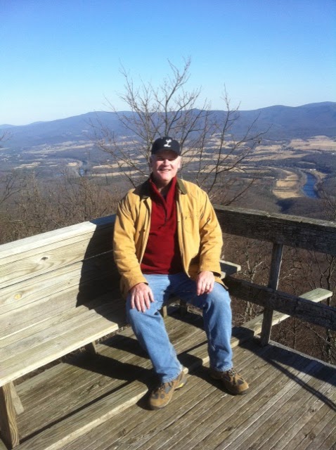
Our route took us along the Laurel Prong route, so we started with a 2-mile section of the Appalachian Trail. It gently climbs along a ridge, gradually becoming steeper as you approach the summit of Hazeltop Mountain, the third highest peak in the Park at 3,812 feet or so. After enjoying the views along a straight stretch of the AT, shown in the photo, there is an overlook close to the summit, but it was obscured by fog on our hike.

Since there were no views to be had, I took a couple of photos of the rocks along the ridge, and one of a fir tree. I’ve read that the firs at these altitudes are at the far southern reach of their natural range – that’s some research I need to get back to. In any case we had a fine specimen here.

Soon after the summit, you’ll reach a concrete post where the blue blazed Laurel Prong trail intersects the AT. For the next two miles or so, you’ll gradually descend along the east side of Hazeltop before an intersection with a yellow blazed fire road and horse trail that leads to Camp Hoover. There are stands of rhododendron here if you are lucky enough to catch them in bloom, and the area includes several minor stream crossings and second growth woods from past clearings – either settlements, or areas that supported the presidential retreat.

Finally you arrive at the Camp Hoover area, where there are still three buildings left from its heyday. There is an historic marker and plenty of interpretive signage and the Prime Minister’s Cabin is set up with a museum that is seasonally open. You can check at the Big Meadows Visitor Center for ranger programs here – our friend Sally is one of the rangers that guides those visits from time to time. The other two buildings left are The President, where Hoover and his wife Lou stayed when they were at the camp, and the Creel, which is where his aides stayed (it is now used by in residence docents, who stay the season in the building).

Chris and I had lunch on one of the terraces and explored the site. There were a couple of trout fisherman hanging around – well geared up, but doing catch and release. It is one of the features of this area that the Laurel Prong and Mill Prong confluence, just below The President, becomes the Rapidan River here and joins the Rappahannock downstream. You can imagine the cheerful sound of these streams providing a restful backdrop to the pressures of Washington in the throes of the Great Depression.

For our route, we decided to climb out of the hollow via the Mill Prong route, another 2 miles or so uphill. A final treat was there to greet us: Big Rock Falls, which was going strong in late winter. The stream itself had a good flow going, so the cascades and eddies were good accompaniment to the climb.

After leaving the White House, Hoover donated the camp to the effort to form the Park. It has been used as a scout camp, and there are some photos of that era around, but I think those activities ended in the 1960’s. Today it is still used for some official functions, but mainly it is a reminder of the 1930’s era and the history of Hoover’s presidency.

I remembered my Pathfinder watch this time, and kept a simple record of the hike, as follows:

  • Trail head: 865 meters/2,682 feet
  • Hazeltop Summit: 1,050 meters/3,255 feet
  • Camp Hoover: 655 meters/2,031 feet
I recorded a total elevation gain of approximately 1,224 feet, since I didn’t calibrate the watch on the route, the difference in my records from the other sources is typical.

* http://www.hikingupward.com/SNP/CampHoover    
** Guide to Shenandoah National Park and Skyline Drive, 4th edition, by Henry Heatwole – now also available as a web resource

Thursday, February 17, 2011

Kennedy Peak: A Moderate GWNF Day Hike

(Photos are corrected now - added 2/18/11)
Last Friday I got into town a little bit earlier than usual, and I went directly to the Food Lion for some supplies. Before going in, I checked the iPhone and found that that my friends at Appalachian Outdoors Adventures had planned a hike at Kennedy Peak for Saturday – also known as Stephens Trail. Then, as I was checking out, CFM walked into the Food Lion…it was sort of like an omen, so I felt compelled to join them.

Now, Hiking Upward has this hike as being at its best in the early spring, before the leaves start to bloom. However, on a number of these summit hikes in the GWNF it’s a good idea to knock them out early in the year, not just because of the views. You want to get them in before the weather heats up too much because of all the critters that will likely be sunning themselves on the rocky summits.


We began our hike by meeting at the store at 10:30 – I arrived a few minutes early, only to find everybody already there and ready to go. Gary, Howard and CFM had made the plan, with me as the straggling fourth, and the dogs would be joining us on the trail as well. I’ve got a photo here of the three of them at an icy patch on the ascent, and then photos of the dogs as well. The one of Howard and the girls is at the summit.

Referring again to Hiking Upward, they have the trail at 8.5 miles, while we have the route as 9.2 miles...I don't have a way to reconcile the difference at this point, so I will go with Gary's and Howard's measure. I rushed out this time without my altimeter watch, so I couldn’t verify the altitude gain, but it’s listed at 1,390 feet. The trail is a big loop that ascends gently through one of the valleys in the GWNF before turning to climb along the ridge. As you approach the peak, the trail steepens until you are working up to the summit, where there is an observation platform with a little shelter built into it. The panorama, shown above, is 360 degrees and includes beautiful views of Page Valley.

I learned a few things on this hike – in some cases, it was info passed along by the AOA guys, but in others, it was just assimilating hiking experience. For example, they showed me an alternate parking area that provides shorter access to the summit, making an out-and-back of about 6.5 miles. And in another case, while I knew that during the winter, the leaf litter in GWNF accumulates in the trail footpaths on north-facing areas, I didn’t understand that these areas are the last to melt after snows, and can be filled with hard-frozen ice hidden under the leaves long after the precipitation has fallen.

There weren’t that many icy patches to deal with in any cases, and most of the climbs were long, gentle stretches – sometimes a couple of miles long, in fact. I have a couple of views looking at Fort Valley here, taking during one of these climbs. The last stretch to the summit was probably steepest, and then a mile or so in the shadow of the mountain was the iciest. But, there were no falls, although there were some close calls.

We took a break near the top, and everyone broke out their lunches. Gary had his backpacking stove there and fixed up a hot meal – read the gear review on his blog at: http://runtechinthevalley.blogspot.com/2011/02/kennedy-peak-loop-gsi-telescoping-spoon.html. One of the highlights of this stop was the peanut butter and raisin sammiches that CFM shared. Just one more little thing I learned on this pleasant walk.

Near the top, there were traces of a fire from the summer – I’ve done some follow-up research on this and will have a post tomorrow. And then you reach the summit with the observation platform and those views; here’s photo here of me up there.

The AOA team maintains a solid pace on these hikes, and we did the 9.2 miles in about 6 hours, about 1.5 miles an hour. That’s quicker than my usual team does these routes, we plan for a mile per hour. I think I learned a few things that will help us with the pace, which in turn will give us more planning flexibility for the summer hikes ahead.

I have wanted to do this hike a long time – Kennedy Peak simply dominates the Page Valley view, and so it’s been a destination for me since I started coming here. Now I’ve got it checked off (and the neighboring Duncan Knob, last photo), and I’m looking forward to getting a few more folks out there with me.

Tuesday, February 1, 2011

Strickler Knob: A Moderate (and incomplete) Day Hike

Our hiking group set out on the enterprise that is Strickler Knob a few weeks back. We had just heard too many good things about the trail from the gang at Appalachian Outdoors Adventures, and the reviews of the hike on Hiking Upward were very tempting. Never mind that we chose possibly the very coldest day of the January to make a go of it – the temperature was 20 degrees at the trailhead – or that I was still a bit jetlagged from my trip to Japan. I can never resist a mountaintop view of Page Valley, so it was easily decided.


With Tom and Andy coming down from Leesburg, and Chris and I setting off from Hawksbill Cabin, we set up a 9 am rendezvous at the Southern Kitchen. On the way to the meeting point, Chris and I drove by the trailhead parking area to make sure that Chrisman hollow was open – it was; we also continued on down to Scotthorn Gap to make sure that we could park there, since I thought we might reconsider the main route for the day.

 
Our plan was to use the Massanutten trailhead and hike down Waterfall Mountain to the gap between it and Strickler, head to the crossroads where Scotthorn Gap trail comes in, and then up the spine of Strickler Knob to the summit. Hiking Upward (no link today because their site won’t open, I’ll correct this later) has the total distance of 9.5 miles for this hike – very aggressive for our first hike of the season, but Strickler has been looming over us for a couple of years now and the gang was chomping at the bit to complete it.

 
This hike also has pretty significant altitude change, so I was prepared with a Plan B and Plan C when we met the guys at Southern Kitchen:

 
  • Plan A – the whole shebang, 9.5 miles, from Hiking Upward;
  • Plan B – the shorter, 5.5 mile trail from the trailhead at Scotthorn Gap; or
  • Plan C – a car shuttle, starting from either trailhead after leaving cars at both, shortening the trip to 7.5 miles.

Over a hearty breakfast, we chose Plan C…we’ve come down from Duncan Knob and Old Rag in the dark before(in fact Chris and I did the last 3 miles of Half Dome in the dark in 2005), something we didn’t want to repeat, and we decided that 9.5 miles would guarantee that same result again. (FYI, a link to Southern Kitchen is here: http://www.roadfood.com/Reviews/Overview.aspx?RefID=427 )

 
I’ve already mentioned how cold it was starting out. I had prepared with long underwear and flannel lined jeans, I knew I had to be careful of getting them wet, but the streams were hard frozen and that wasn’t going to be a problem. The other guys chose technical hiking pants over long underwear – I think everyone was okay for the cold, but as we warmed up from hiking it was challenging to stay comfortable.

 
From the Massanutten Trailhead, Strickler is a hike that doesn’t cut any slack. About a quarter of a mile in, there is a half mile long descent that plunges 800 feet in a series of switchbacks on a rocky trail – challenging footing with winter leaf litter still covering the trail and with icy spots here and there in the shade. Andy and I synchronized our Casio Pathfinders and both got good readings on the altitude change, I’m glad to say. Chris didn’t fire up this feature of the Suunto, so we didn’t compare Tech Watch results.

 
From the bottom of that descent to the next waypoint, the crossroads with the Scotthorn Gap trail, is about 2 miles. There is a gentle climb over this distance, and the path more or less follows a stream, which you cross twice in this valley. It was very pretty in this hollow, given the cold and the fact that the leaves were down. But you could hear the happy little stream under the ice, and nobody was complaining about the trail difficulty at all.

 
From our past experience, our worries about running out of daylight were driving us. Our usual pace is about a mile per hour on these hikes, and we knew that wouldn’t be good enough – it’s why we made alternate plans. Still, at one point, we did one of these miles in a half hour. I think it was part of one of the old furnace roads, and footing was tough, but we really covered that distance.

 
At last we reached the way point, slung off our packs for snacks, and reconnoitered our situation. We were at the start of the ridge trek for this trail, with about an hour to 90 minutes of daylight left, with 3 miles of rock scramble to look forward to before getting back here, only a mile to a mile and a half on an easy fire road trail from the car. The math wasn’t working, so we had to bag it.

 
Still, all in all, a good workout of about 5.5 miles, and now we are more familiar with this trail’s logistics. We’re going to take it on again at some point this winter, maybe early spring (we prefer not to do the rock scrambles in the summer due to snakes sunning themselves on the rocks).

Wednesday, September 15, 2010

Dolly Sods Wilderness - a Moderate Day Hike, Part 3

For my final post on Dolly Sods, I’ll close out with a couple of photos of the varied landscapes we encountered. First, a note about the hike – it’s interesting to think that we might have been over-prepared for what we encountered, equipped with too much information, so that it colored our expectations. It was a challenging hike, at 10.5 miles longer than we might usually plan – but we didn’t get our boots sucked off of us in a mile-long bog, and we didn’t get lost on any of the trails…we didn’t even make a wrong turn in the wilderness, thanks to these cairns and the signs I posted on yesterday.

In fact, this series of cairns marks a trail intersection, a waypoint that we used to make a southward turn in our route. Later, we saw cairns that seemed to be randomly placed; maybe they were built where they were because somebody found some rocks, or because they were marking a favorite campsite, or because they were setting up some forgotten artillery target during the World War II training days…

The next shot here is of a view across a meadow that we had early in our hike. Looking at the rocks in the distance, I noticed that their color, texture, and shape was very similar to exposed rocks made of Tuscarora quartzite at a similar altitude in Shenandoah National Park and on Duncan Knob in GWNF. Here are links to past reviews of hikes to these destinations: Blackrock Summit - http://hawksbillcabin.blogspot.com/2009/11/third-blackrock-hike-in-sun.html, and Duncan Knob - http://hawksbillcabin.blogspot.com/2009/03/duncan-knob-summit-and-final.html.
Next shot, a meadow we encountered fairly late in the hike, about 7.5 miles in. On the northern part of the hike we did, we found ourselves frequently ducking into stands of trees – sometimes hardwoods, sometimes evergreens – and then emerging in a meadow like this, which might be a half mile across. Then after a slight descent or climb, we’d duck back into a stand of trees.

This final shot was taken in one of my favorite little meadows. This one was quite small, enclosed by evergreen stands. But it was overrun by these white flowers – any thoughts on what they are would be helpful. They were beautiful, and hopefully the photo gives an idea of how they glowed in the afternoon sunlight.

Tomorrow, I’ll add a final post about the trip to West Virginia, of some sightseeing we did on Sunday, a recovery day, as we planned to head back home in Northern Virginia.  That will be my last post this week due to some scheduling difficulties.