Ramble On

Showing posts with label Skyline Drive. Show all posts

Friday, November 9, 2012

Snow on the Mountain

One of the things that made Hurricane Sandy such a devastating storm was the combination of two wintry systems with the tropical one.  While the full force of that storm was felt in New Jersey and New York, we had some impact in Virginia.

And as the news of the storm began to reach Mary and me in Alexandria, one story I saw was that as much as a foot of snow was getting dumped up in Shenandoah National Park.  Skyline Drive was closed, but in the typically beautiful weather that follows a storm like this one, the park was soon reopened.

I'd seen that there were major accumulations at Big Meadow, which is in the part of the park with the highest elevations.  The lodge there is only four miles away from Hawksbill Cabin - as the crow flies - and about 3,000 feet above us.  The story goes that before the trees grew in to our neighborhood, you could see it from the brick terrace.

So Mary and I took a drive up to the park, and I wasn't disappointed in my search for early season snow.  These first two photos are from the Jewell Hollow overlook, looking down into the Valley.  You can catch a glimpse of Lake Arrowhead to the west in one of them.

The final picture I'm sharing today is a view of the Big Meadow area from the nature center across Skyline Drive.  Sure enough, this is where the largest accumulations were - it was chilly enough up there for the snow to stay down.

While we didn't walk out into it, it was the inspiration for another treat: we went over to the camp store there and had a hot chocolate before we got back on the road home.

Tuesday, May 8, 2012

Turk Mountain: An Easy SNP Day Hike


At the summit of Turk Mountain

As I mentioned yesterday, I took Tessie out for an inaugural hike in Shenandoah National Park recently, and chose the easy Turk Mountain summit hike as our destination.  Earlier we’d warmed up a little on Calf Mountain after entering the Park from Waynesboro, and afterwards we drove a few miles north on Skyline Drive to the trailhead for the summit.

There is a more challenging Turk Mountain hike described on Hiking Upward, and linked below.  They list their version as a 10.4 mile loop with multiple stream crossings and 2,400+ feet of altitude gain.  That’s not the hike Tessie and I took – ours started at the Turk Gap parking area, milepost 94.1, and we did a 2.2 mile out-and-back with only about 480 feet of altitude gain, net.

This is a well-maintained trail that runs along the AT for part of the way.  In fact, Tessie and I encountered a pair of north bound AT section hikers taking a lunch break at the parking area.  What a wet day it was – I’m sure that was keeping that appetite up, but I didn’t have any trail magic to share with them.

Rhodies
As you can see from the sparseness of my photography on this trail, I was pretty focused on working with Tessie on her leash for the route.  Still, we did enjoy the rhododendrons in bloom, and made note of several geologic layers that the trail passes through, including a couple of talus fields.  The rainy day really brought out the colors of the lichen that covered many of these stones.

Talus field
Upon reaching the summit, given the rainy day and overcast skies, there is not a lot I can report about the views that are supposed to be the highlight of this hike.  I’m one who doesn’t mind not having the view if the effect of the weather is interesting enough, and here it was, with wispy clouds blowing through the tree branches. 

This stony ridge is narrow and tough for footing, and my little dog looked up at me for guidance in some of the areas up there.   We had a good bonding experience – I’ll take her back on the trail sometime soon, and hopefully will be able to join my friends at Appalachian Outdoors Adventures with their dogs by the end of the year.

As far as the trail goes, this one offers a very typical experience for Park visitors.  It is a good one down in the Southern District, where there aren’t typically many crowds on the trails, so it has that going for it.  A hiker who has done the research on the vegetation, wildlife, and history of the Park will certainly find a lot here; and if you take the time to dig into the geology of the Park there is a lot to ponder in the nearly 500 feet of elevation gain here – you probably cover two or three hundred million years of geological history.

It’s one I definitely will do again, and I may even take up this route from Hiking Upward:

Thursday, December 1, 2011

Best Easy Day Hikes Shenandoah - New Edition

When I posted about our little day hike to Bear Fence Mountain last weekend, among the things I noticed while writing was that the new edition of "Best Easy Day Hikes Shenandoah National Park" has been published.  This book, compiled and written by Bert and Jane Gildart, is the 4th edition, and was published earlier this year.  It updates the 3rd edition that was published in 2006; I have an Amazon link at the end of the post if you'd like to check it out.

When Mary and I bought Hawksbill Cabin in 2007, I figured that since Shenandoah National Park was so close - Hawksbill Mountain looms over the drive into our place, nearby Hawksbill Creek draws its source from a spring near Big Meadows, and we can see Tanners Ridge from our brick terrace - that I should make a point of getting to know the Park best I could.  I used the 3rd edition as a guide, setting a goal to complete all of the hikes in the book, an objective I fulfilled in 2010. 

On first review the major difference is the inclusion of 27 hikes in the 4th edition, as opposed to 26 in the 3rd.  Not only are there additional hikes, but some of the old ones have been deleted or replaced.  A district by district review shows that there are now 6 hikes in the North District, where there were five; there are 15 in the Central District, the same as before; and there are 6 in the South District, the same number as were in the 3rd edition.

The additional hike in the North District is Fort Windham Rocks, a 0.8 mile out-and-back with negligible elevation gain.  In the Central District, a second route to the peak at Mary's Rock has been added: "Mary's Rock  South," a 2.6 mile out-and-back that is shorter and has less elevation gain than the traditional "Mary's Rock North" route.  The entry for Betty's Rock and Crescent Rock has been deleted from the Central District list.  The South District list remains the same.

Generally, I'll be interested to get into the individual hike reviews in more detail to check out the updates.  Our Park is dynamic in that it used to be settled and covered by farms; while the establishment of the Park retains some controversy in the surrounding areas, the inevitable progress of nature's reclamation is one of the features of the experience, and that means that the trails are constantly changing.  Where there was a view in the past, there may be a new forest obscuring it now, for example...or some unusual flora or fauna may have re-established itself somewhere, causing the visitor to focus more on the micro-landscape as opposed to the wonderful views from Skyline Drive.

I have my favorites on this list, and at the same time, if the choice were mine, there are a few I would leave off.  But this guide has been very useful to me during my adventures in the Park, and generally I'm very happy to see that it has been updated.  Once I found out it had finally been published I couldn't wait to get a copy for myself.

Amazon link:

Monday, August 22, 2011

Warm-ups: Hawksbill and Calf Mountain Hikes

From the headline of this post, a casual reader might ask, "Warm-up for what?" Since most of the summer's heat and humidity has passed without me taking another 75@75 hike, I've been worried about losing traction on that goal. 

One of my hiking buddies agreed that we should make a goal of Old Rag (photo here from an overlook on Skyline Drive), and so we did, but I took the extra precaution of getting out on a couple of leg stretchers in the Park first: Hawksbill Mountain and Calf Mountain.  I've reviewed both trails before (check the Easy Day Hikes label at the end of this post), but I'll make a note of them again today.

Since Tuesday is market day at the farm, I'm often out of there by noon.  The weather was so good last week, and since I knew that the Friday Old Rag outing was fast approaching, I decided a quick hike to the summit of Hawksbill Mountain might be productive.  Off I went for a late afternoon trip.

I found myself practically skipping along from the Upper Hawksbill parking area. Heatwole lists the trail I took as 1.7 miles round trip and 690 feet of elevation gain; I think it's around 400 feet net, if that.  Definitely not an intermediate hike in my classification, where the distance needs to be five or more miles and net elevation gain of 500 feet or more.  Net elevation gain, as I am using the term, means the elevation difference between the hike’s highest and lowest points; Heatwole generally measures the aggregate elevation change as I understand it.

So all in all a pleasant little hike up the mountain, where I spent an hour or so up at the summit enjoying the cool breezes and chatting with two or three groups of tourists passing through on their summer vacations.  Here's a photo of the day use shelter near the summit of Hawksbill Mountain (incidentally, the highest peak in the Park, at 4,049 feet, per Heatwole).

Typically, I can expect a tough day at the farm on Wednesday, and last week was no exception...no fecal dust to show for the experience this week, but I do have a couple of spots where some poison ivy is showing up after some dirty work in the fields.  After that, I left with the thought that I might put together another short hike for Thursday to continue my preparation for Friday's Old Rag climb.

I haven't been down to Waynesboro in a while, so I decided I'd get a route together down in the South District of the Park - and take advantage of being there to get lunch at Scotto's (don't miss it when you are in Waynesboro - I like the baked ziti specialty), and to visit Rockfish Gap Outfitters, which is conveniently located on the road up to the Park entrance.

My destination was Calf Mountain.  Again, an easy little hike with minimal elevation gain (Heatwole lists a longer hike than I was after, although I probably hit much of the elevation he lists: 495 feet; but I took no measurements).

These first two photos from the Calf Mountain trip show why I enjoy this spot in the Park so much: the open former pasture where Skyline Drive passes through the middle, with the Appalachian Trail disecting it.

I first came here a couple of years ago, it was the first hike I took after we lost Gracie Dog to renal failure, so that outing had a purpose for grieving.  I guess nowadays when I am here I get a fond memory or two of our friend.  Maybe in the winter I'll take Tessie up here and she can be part of that whole thing too.

There are a couple of other reasons I like this hike - it's an easy outing, even if you head back into the woods, which I didn't; there are a couple of hilltops with low vegetation so there are nice views looking down on the Piedmont; and there are leftover traces of human use of this land in fruit trees and domesticated shrubs around the pasture and further back on the trail.

Mary thinks we've seen a grapevine gone feral in the woods there and I wouldn't be surprised.  But the readily visible and identifiable trees are the apples and peaches.  We visited last fall and caught site of a group of AT section hikers who had picked some of the fruit and sat in the shade eating it.  They told us it was very tasty...my guess is it is an heirloom variety that would be hard to get to grow true, but still would be worth trying.  I don't know how you might go about that, though.

Tuesday, May 31, 2011

Wild, Wild Life

This week I will be posting a review of the Piney Branch-Piney Bridge hike that Chris, Tom and I did on Sunday. For now, I will leave it as having been a pretty rigorous trail, for several reasons – including the heat, which was in the ‘90’s. Today, a short post on the wildlife we saw…there was, indeed, plenty to behold both in rumors of encounters and in actual encounters.

It all began with our rendezvous in the Elk Wallow wayside’s parking lot. There was a lady standing next to her car waving her cigarette, talking to Chris, telling him that a deer had been hit on the drive nearby. That might not be an infrequent event – I’ve had some close calls in the dusk hours myself up there - but the tale just got taller.

She said that “those kids over there” said they’d seen a bear, which evidently had caught scent of the blood and started nosing around the area of the accident. I looked over to where the kids were – there were two ranger vehicles with them; I decided this part was made up, although I will give the lady credit, she was just repeating something she thought she’d heard. See, locking down two rangers in a wayside parking lot with a bear on the loose - on the hunt, even - on one of the busiest visitor weekends of the year just didn’t make sense.

Chris and Tom got busy outfitting themselves and I continued to observe the events going on around us. “Those kids” the lady mentioned were hanging around a mini-van with Ohio plates. The radiator grill was all busted apart with a few pieces just barely hanging on. The owner, maybe those kids’ dad, was reaching around under the hood…my guess, trying to get the thing road-worthy again after a deer strike.

Finally the rangers finished up their business over there and drove away. I quickly moved on to breakfast, as by now, the wayside grill was open and I went in for a tasty breakfast sammich; meanwhile, Chris, at least, was finally outfitted and he went over to the men’s room.

While he was there, he heard the mini-van owner talking to the kids. “Now you kids – how many times have I told you all how to behave in front of the cops?” he said. “We got enough on our heads without you kids bringing more trouble. There’s going to be a whuppin’ later on after all this is finished up!”

After 20 minutes and one breakfast sammich later, we were at the trailhead trying to make sense of that scene for a few minutes. Well, just some hard luck with a family on a little recreational weekend, we decided, and we were underway.

Getting to the real wildlife that we encountered, a large toad was the first animal we saw. That was unusual for me in the Park. I’ve run into lots of other creatures but never a toad, and this was a good sized one. There were plenty of insects around, so he was probably pretty contented on that stretch of path.

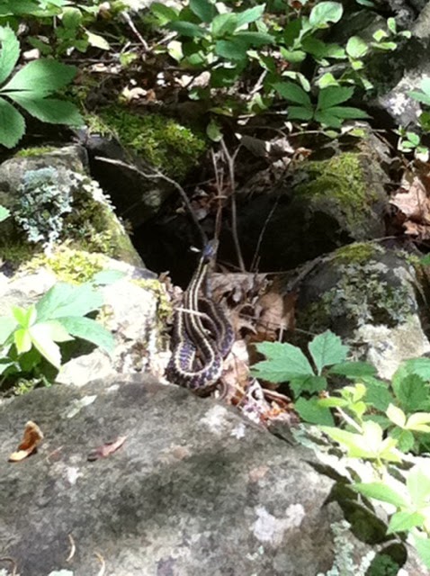
The ribbon snake in the photo that accompanies this post was the next animal. You know, snakes aren’t the most popular animal in the forest because they are so sneaky. You’re not looking for them, and suddenly there they are, popping up in just the place you want to sit down to have lunch.

So in a sense, running into a ribbon snake was a lucky encounter, rather than an unlucky one. They’re not venomous; and at an average of two feet long – as this one was – they’re not very threatening. So we kept an eye on it over there, maybe two yards away, while we took a lunch break.

Eventually it slithered on away. My book on snakes (Amazon link below) says the ribbon snake likes the environment we were in there at that spot, near a stream, in the cool shade of a forest. I’d make a note that as far as I can tell, no snake native to these United States that is striped lengthwise is venomous. So if you encounter a snake with that coloring, try to enjoy the encounter rather than run terrified and screaming away.

We also ran into one of my favorites, a ring-neck snake. Here is a link to a photo of one that I found next to the pool: http://hawksbillcabin.blogspot.com/2008/08/battle-of-species-snakes-in-pool.html. These little guys – the size ranges up to 18 inches long, although the ones I have seen have only been six inches or so – are hunters, like many reptiles, if you can believe that. Their meals are mostly bugs, so they’re another friend in the forest.

When we finished the hike, we were de-accessioning our gear at the trailhead and a ranger drove by. He stopped to chat about conditions on the trail, making sure everything was okay with us and other hikers. We were superior, but tired.

But since he was chatty, I did ask him about the bear story. He said his shift had begun at noon (the bear situation would have been before 8am, I’m guessing), but if something like that had happened he would have heard. So it was just a tall tale, although the ranger did say, “Oh yeah, there have been plenty of bears about lately!”

We decided to head out of the Park by way of Elk Wallow again. It was crowded, but as we parked, I saw the derelict mini-van sitting there, probably waiting for parts, or for a tow. No sign of those kids or their carefully law-abiding dad. Then we were on our way.

Our wildlife encounters weren’t quite done, though. Heading south to the Thornton Gap entrance, there was a turkey hen sitting near the road, stopping traffic. And after we left the park, there was a snapping turtle crossing 211 coming up from pass run. Some nice local guy had stopped to help her get across - I hope he wasn’t bitten, although the females seem to be pretty docile at egg-laying time, really focused on getting about their business.

Wednesday, December 22, 2010

Byrds Nest Summit and Byrds Nest Shelter Number 4 - An Easy SNP Day Hike

This trail ended up being my final hike out of the Best Easy Day Hikes book, number 26 of the 26 that are reviewed there. Both the Easy Day Hikes book and Heatwole describe the Byrds Nest Summit and Shelter Number 4 as an easy hike through pleasant forest scenery, and I couldn’t argue with that. Although the Easy Day Hikes book outlines a circuit of 3.2 miles and climb of nearly 500 feet, I added in a little section of the AT that passes through here, freelancing off of the trail map I picked up at the entry station – so my hike was probably a little longer and had more altitude variation than their review had.


I should note that I had some photos taken in June 2010 to accompany this post, but failed to upload them…when I dropped the Moto RAZR last week I lost them. Maybe sometime I’ll revisit Byrds Nest Shelter Number 4, and if I do, I’ll post photos at that time.

Interestingly, looking at the Heatwole guide (my copy is the 1988 fourth edition), Henry describes the facilities at the shelter as having a pit toilet and a water faucet, but I either didn’t see or didn’t notice these during my visit…Heatwole also mentions a couple of nearby viewpoints that should be only a couple of hundred yards away, but I think they are overgrown now, and Henry goes as far as to qualify the description of them with the remark, “if they are still there.”

For a few minutes I considered the quality of this location, and then I chuckled to myself remembering a couple of passages in Bill Bryson’s “A Walk in the Woods.” In one place, he mentions a shelter somewhere south of Byrds Nest Shelter 4 where some Boy Scouts arrive shortly after he and hiking buddy Katz arrive. The Boy Scouts set to work, are cheerfully incompetent, and are “better than TV.”

In another passage Bryson describes coming to Gravel Springs Hut, which is north of Byrds Nest 4, again with Katz, but this time arriving in the rain. They are joined there by a group of six day hikers who have decided to “rough it” in overnight in the shelter, complete with libations.

Upon encountering Katz and Bryson in the shelter, one of the women says, “Ooh, do we have to share?” and things rapidly go downhill from there. Katz gets a form of revenge at the end of the story as they part ways – and that’s what gave me a laugh as I looked out on the meadow in front of the shelter. Gravel Springs Hut is probably another dozen miles north of Byrds Nest 4, but still, I was happy for the little memory.

Things were going nicely for a short while, and the shelter was a very nice facility, looking out over a little meadow. The weather was changing, it was growing overcast, and then I heard some thunder rumbling off in the distance. Growing concerned, I sped off into the woods.

With so many trails coming into the shelter area, I must have made a wrong turn somewhere along the way, and found myself on a side tail that I could not find on the map in the Easy Day Hikes book (I keep it in my pocket for reference when I do these hikes). I decided to put that book away and exclusively use the Park Service map, combined with the trusty compass on my Pathfinder watch, in order to navigate back to Skyline Drive.

It was very dark in the woods for the remainder of the hike, and my anxiety about the wrong turn made the walk seem very long – even though it really wasn’t. I remember that this was quite a beautiful part of the forest, as a matter of fact, in a hollow on the west side of the ridge, and not yet fully leafed out. At those times where I could put the worries out of my mind I enjoyed the views, and thought that a car shuttle hike doing a few miles of the AT through this area could be nice.

For all the anxiety, this pleasant memory of a book well read and the glimpses of natural beauty made up this into a not-so-bad experience. I exited the woods at Skyline Drive, and quickly assessed that I was south of where I had parked the car. I hiked a couple of hundred yards along the Drive back to the parking lot.

The moral of this story is simple – while it is relatively difficult to get lost in Shenandoah National Park, since you are always only a few miles away from Skyline Drive if you are on a blue or white blazed trail, you should always take the precaution of having a map, a compass, and some extra drinking water with you. Given the terrain, there are still a lot of areas where cell service doesn’t reach. Even so, it shouldn’t be too difficult to survive here with these things, and being without them will probably more likely mean you are in for some discomfort rather than in an actual life-threatening situation.

So that’s a lesson I’ve taken to heart – even though I will scamper off on many of the Easy Day Hikes book’s hikes sans backpack, I will typically have extra water, a couple of maps, and my trusty Casio Pathfinder with compass on hand. Since I use my cell phone for photographs, I always have it with me, too, although I don’t expect to have service much of the time on the hikes.

To close the post, here are Amazon links to the Easy Day Hikes book and the Bryson book, both mentioned above. Appalachian Outdoors Adventures in Luray often has them in stock.  You can also find a link to the Casio Pathfinder over there - - > in the right hand column!


Friday, December 3, 2010

On Top of Old Stonyman

To close out our holiday weekend, Mary and I decided to take a drive on Skyline Drive, choosing the little Stonyman trail for a season-ending adventure.  It was a very clear, if bracingly cold day, and with most of the Park's lodging and dining facilities closing, we figured we might come close to having the place to ourselves.

That's almost never the case at Shenandoah National Park, due to its proximity to DC, Baltimore, Richmond, and other east coast population centers.  But it does slow down and there are times when you'll find excellent surprises.

The temperature was hovering around 30 degrees once we were up at altitude - enough to freeze the little rivulets you often see on the back side of Stonyman.  Later on in the winter, these will be bonafide ice pillars, but for now they are just getting their tenuous start.

Here's a pair of views from the summit, one looking to the north and over Lake Arrowhead, and the other a westward view that includes much of the town of Luray. 

It's not something I do all that often, but while we were at Skyland, I put a quarter in the telescope machine there on the veranda and took a look at the town.  With the leaves down, you really can get a nice view from up there.  I imagine you'd have this all to yourself at times during the winter if you wanted to make a picnic on a warmer day.

There weren't any traces of the fall fires we had the previous week.  With black powder hunting season over, maybe there won't be anymore...just saying.

Another thing interesting about the view from up there on this day was the notable inversion layer to the west of Massanutten.  Traffic was crazy on I-81, we were told, and maybe that's what was causing that dirty haze over in that part of the Valley.  I thought it reminded me of Denver, or Los Angeles...

For a final shot of the day, here is a tech watch geek update.  I remembered to turn on my Pathfinder's altimeter function as we were coming back down from Stonyman summit.  When we got to the intersection sign with altitude, I checked my reading - it showed 1,060 meters, same as it did the last time I passed by the sign, last week!  That's 3,286 feet, so a typical adjustment had to be made with the reading...but I am surprised that I got the same altitude two times in a row.  Maybe I am onto something.

While the majority of Park facilities closed for the season this weekend, Skyline Drive remains open for the winter, except during inclement weather.  I'm looking forward to a few little excursions this season if I can get my little hiking group up for it.

Monday, November 22, 2010

Not a Shy Buck...

When I was up in the Park on Saturday, this big fella was hanging out beside Skyline Drive.  I mean really, doesn't he know what season it is?

In my experience it is pretty rare to encounter antlered deer up in the Park; they seem to stay out of sight for the most part.  Last year I saw a five year old up at Big Meadow - that was a rack that really stopped traffic, especially since he was in one of the most popular parts of the Park on one of the busiest weekends!

Actually, the Park started closing some sections for hunting season last weekend.  As I entered on Saturday afternoon, I was advised that the North District (Front Royal to Thornton Gap) and the South District (Elkton to Waynesboro) would close at five p.m. until daylight for to prevent illegal hunting.  I'm not sure about the permitting situation, but I've heard that the hunting here is reserved for employees.

I've learned (and thanks to posumcop for pointing me in the right direction) that these closures are actually to prevent illegal hunting in the Park.  There is a link to learn more here:  http://www.nps.gov/shen/parknews/park-announces-night-closure-of-the-skyline-drive-during-hunting-season.htm
If you're planning a visit, be sure and check in for potential closings.  You don't want to find yourself locked in the Park with hunting going on  and have to hike out!

Monday, September 27, 2010

As seen on Skyline Drive: Wild Turkeys

This Saturday I took a little cruise on Skyline Drive to check out a new hike near Big Meadows.  On my way back, I encountered one of those little traffic jams that means some kind of wildlife has been spotted in the woods.  Maybe I'm a bit cynical about this now - the random stops on that road are quite dangerous, and most of the time people have stopped to look at a deer, so now that I've hit one and had a $2,000 car repair because of it I just don't appreciate the scenic wonder in the same way the rest of my (probably) Northern Virginia fellow travelers do.

However, what was crossing Skyline Drive the other night was out of the ordinary - a flock of about two dozen turkeys!  I've seen them in ones and twos before, but never so many at one time.  It was fascinating, and got me thinking about...well, white meat or dark meat - these hens were about as big as Canada geese.  I managed to snap off two quick photos, but one (the one I am not publishing, of course) didn't have a single bird in it...here you can see quite a few of them.

I remembered that I had a photo stored of a yearling cub I had seen back in June in nearly the same place, so I uploaded it and will share it now.  It's in the woods here foraging, probably only 30 feet or so from the roadway.

I saw one on my hike the other day, too.  It scampered across the trail 50 feet or so ahead of me - it saw and heard me coming, and it ran for a couple of hundred yards before it dissappeared into the woods.  By the way, my friend Evan took the time to put up a few posts about black bears on his blog - including how to increase your chances of seeing one, and suggestions for what to do if you do see one.  Click on this link and look for the posts on black bears:  http://wildlifeinphotography.com/species/.

Although the hike was good exercise, I had to break my attempt short.  More on that next post.

Tuesday, September 7, 2010

Calf Mountain Revisited: An Easy Shenandoah National Park Day Hike

Last Labor Day, as I was tooling through the hikes in my copy of the Best Easy Day Hikes book (Amazon link below), one of my favorites turned out to be this short hike in the southern district of the Park.  At the Beagle Gap sign and the 99.5 mile post, the trail head is less than 10 miles from the Rockfish Gap entrance; but you have to know about it before you arrive because maps aren't available at the entrance stations for this part of the Park.

This area still shows traces of the old farms that used to populate this ridge - in the cleared land that was a pasture, and in the orchards that still bear fruit - and witness - to the way of life that used to hold sway.  Near the parking area there is a stand of peach trees that has fruit at this time of year, and there is an apple orchard with perhaps a dozen or so trees in the old pasture - which also is crowded with staghorn sumac, with its blazing top at this time of year.

Mary and I set out eastward for about three quarters of a mile to the first summit of Calf Mountain.  We encountered some weekend backpackers on the route who had picked a few of the apples (mostly Macintosh by our reckoning) and were cheerfully crunching on them as we passed.  When I asked how they were, the response was, "They're awesome, dude!  We got 'em from the tree just around the bend, a branch leans down over the trail."

Sure enough, that tree was there, but everyone of the trees was in pretty easy reach if you were so inclined.  We also saw some grape vines mixed in the woods - none of the photos were worth keeping though.  We were interested in knowing what variety these might be and if collecting a cutting (keeping in mind that Park service regulations must be followed for this) might be worthwhile for a Virginia vineyard. 

After our short walk eastward, we crossed Skyline Drive to make a symmetrical walk to one of the other summits of Calf Mountain (as far as I can tell from my readings in the guides, there are three).  We didn't go as far as the radar towers, and we didn't find the Park boundary (one of the things to know about the Park down here is that it is very narrow - a some points the AT wanders in and out of the Park onto private land, although it is owned by a conservancy).

While on the westward side there weren't as many fruit trees, we found a little rocky outcropping and meadow to adventure out to not far off of the trail  We were rewarded with a view to the east; our guess was that we were looking down at Crozet or Albemarle, in the direction of Charlottesville. 

We may have gone a total of three miles, and it is a very easy hike - the entire route is on the AT so it's all pretty well maintained.  Because of the fruit trees, I think this one is best done in the fall.

Thursday, May 27, 2010

The Tech-watch Geek Returns

Now that I have my Casio Pathfinder...well, it gives me a gadget to play with when I go on these hikes.  And, fellow hikers, remember this, whenever you set out on a trail head from Skyline Drive you will either climb first, then descend back to your starting point, or you will descend first, and climb back to the starting point. 

Why?  Because the Drive follows the Ridge.  So consider your route before you start, and be prepared for the climb, whether it is the start or end of your hike.

In the case of the Hightop Mountain hike I took last Sunday, the hike bagan with the ascent.  Although it was a mild climb at the start and end, there were some steep sections through the middle, and even a switchback or two to help the path make its way up the mountain.

I took a few measurements with the altimeter function, summarized in the table below.

In looking at the entries I've numbered "5" and "5a" - note the difference.  The error factor is less at the lower altitude, and had changed by 100 feet by the time I had reached the summit. 

There are a couple of potential reasons for this.  Of course, one of them is operator malfunction, but more likely, there was a change of barometric pressure during my hike.  The other possible reason for this inaccuracy is a temperature change during the hike - I don't remember that being the case, so I am pretty sure the pressure was rising...in fact, there had been storms overnight and the atmosphere was still clearing when I got up on the mountain.

The other thing I did while I was at the summit was to take a reading on my compass.  North was indicated as 292 degrees, so I was facing approximately west up there on my ledge (photo shows the view - note that it was obscured by clouds!  The town of Elkton was somewhere out there).

I guess I am pretty comfortable with the watch's basic functions now, and I need to move on and learn how to do a couple of things with it - setting a reference altitude, and also calibrating the compass.  And just now I deleted some earlier records. 

So it's a work in progress, but it's coming along.

Hey, if you want to be like me, here's my watch on Amazon!


Wednesday, May 26, 2010

Hightop Mountain: An Easy Shenandoah National Park Day Hike

Sunday morning I had planned a hike up in Shenandoah National Park, thinking I’d go where ever the mood hit me to go using my Easy Day Hikes book as a guide. It turned out that I had left the book in Alexandria, so I referred to my “Hikes to Peaks and Vistas” book, from the Shenandoah National Park Association (quick link to the book: http://www.snpbooks.org/mm5/merchant.mvc?Screen=PROD&Store_Code=SNPBOOKS&Product_Code=P%26V&Category_Code=BK) and picked the Hightop Mountain Summit.


The short Heatwole guide description of this trail says it climbs about 935 feet and is about 3 miles round trip, following the Appalachian Trail the whole route. That makes it a bit steeper than Mary’s Rock, so I was expecting a workout. I guess the walking I’ve been doing lately, since my office moved downtown, is helping and this wasn’t so bad for me. The first two photos are of the trailhead sign and some large bolders near the start of the hike.

Besides the possibility of views on this hike, I was hoping to catch a view of some trilliums, since I knew as May advanced they were probably already past peak. There were quite a few wildflowers blooming, and I did find a few red trilliums scattered around ¾ of the way to the summit. I plan to post a few of the wildflowers I saw in a writeup tomorrow or Friday – I also have a “Tech-watch Geek” post coming.

Heatwole goes on to mention some history associated with this area of the Park, and the 3,585 foot summit of the mountain (the views are actually from ledges just below the summit):

“On March 18, 1669, the explorer John Lederer first reached the crest of the Blue Ridge. The ledge you’re standing on may be the point from which he first saw the Shenandoah Valley.”

When I started my hike, it was sunny at the trailhead, but I could see that low clouds were swirling partway up the mountain, obscuring the summit. So I knew the views might be limited from the top – and that’s what I found. However, I do like the experience of being up on the summit in the clouds, which these two photos show (click on them and they will open in a window for a larger view).

There is also a spring and an AT hut near here, so I walked the additional half mile or so to the spring. I looked around for a trail leading to the shelter but couldn’t find a trace of it, so I turned back and spent some more time enjoying the views into the clouds from the cliff.

I met two thru-hikers when I got back to the trailhead. I didn’t have anything to share with them, or I would have…they’d both been on the Trail for about 10 weeks. While they were close by each other in this stretch, they weren’t hiking together – I encountered them about 5 minutes apart while I was taking off my pack and putting away my hiking poles. I didn’t catch their trail names.

Thursday, April 15, 2010

A New Web-based Guide to Shenandoah National Park and Skyline Drive

One resource I frequently reference when planning hikes in the Shenandoah National Park is what I call the "Heatwole guide."  The actual title is "Guide to Shenandoah National Park and Skyline Drive," it was original published by Henry Heatwole in 1978 as a hardcopy volume (I have a copy of the 1988 edition).  The lore of the guide is that Henry painstakingly researched, interviewed, sketched, and wrote about nearly everything there is to know about in the Park, and he updated the book several times before he passed away.

I found the guide's on-line version, which hadn't been updated since the last publication - it still made a good reference for many of the hikes I've taken.

Last year I learned that there has been an ongoing effort to update the guide and republish it on the web.  Finally, it is user-ready after a five year effort.  The team sent me a press release on the new web version earlier this week, which I am re-posting below.  I'm looking forward to consulting the guide for my next hike!
---
For Immediate Release......


Spring 2010

New Web Based Guide to Shenandoah National Park Announced

After five years of work a new web based, free resource for visitors to Shenandoah National Park is available to enhance the visitor experience. This new guide is designed to provide an orientation for first time visitors and in-depth information about many park elements for all visitors of this well loved national park. The guide features general park information, full coverage of Skyline Drive, a comprehensive set of 110 hike recommendations with new maps and updated hike descriptions as well as a careful look at the park’s history, and insightful background about flora and fauna. It is illustrated with superlative new photography and also includes historic photos from the park’s early days.

The guide is dedicated to Henry Heatwole who authored the popular Guide to Shenandoah Park and Skyline Drive first published in 1978 by the Shenandoah Park Association. Almost 75,000 copies were sold. A generation of users has grown to know, experience, and love the park based on Henry’s knowledge, experience and remarkable insights. His observations range from the eons of the park’s geology, to the reality of the park’s establishment, to the excitement of observing a wildflower blooming along a trail for a short time in the spring. This new guide, though significantly updated, remains basically Henry’s work. It is hoped that several more generations of park users will benefit from his labor of love.

The guide is an all volunteer effort. First steps involved hiking and field checking and updating the text relating to Skyline Drive and the 110 hikes constituting more than 430 miles of trails. The field work was begun by members of the board of the Shenandoah National Park Association, who were soon joined by the members of the Potomac Appalachian Trail Club and others. The reviewers found many changes since the original field work was done over thirty years ago. The Park Service generously provided new maps that superimpose the hikes on their base maps.

The new guide can be found at:

http://www.guidetosnp.com/

It is hoped that future generations will continue to experience and enjoy the visionary expectations of the park’s founders and Henry Heatwole’s love of and insight into most every element of the park.

Wednesday, February 24, 2010

More thoughts on Fibrowatt impacts

Following up on the discussion of potential emissions from a power plant in the Valley, today I wanted to think about some different supporting infrastructure that will need to be constructed. The starting point for this analysis is Homeland Renewable Energy’s website, Fibrowatt’s parent company, specifically the technical data sheet about the Minnesota plant, which is the first reference link at the end of the post.

There are two points to call out specifically, both of which will require specialized infrastructure: (1) the stack height of 300 feet, and (2) the voltage that power generated at the plant is delivered to the grid – 115kV.

Starting with the stack height, it’s hard to get a perspective on how tall 300 feet is in Page County, since the Valley is surrounded by two mountain ridges. The nearby peaks in Shenandoah National Park, notably Stonyman and Hawksbill, are 4,000 feet tall. Two easily identifiable peaks in the shorter Masssanutten ridge are Kennedy peak and Duncan Knob, at between 2,500 and 2,800 feet tall.

There are numerous photographs of panaoramic views from these summits on the Hiking Upward site (www.hikingupward.com) or from Google Earth. From those heights, tall constructed objects are visible, but for the time being there are none over 150 feet tall, these being cell towers. As I drove through Luray last weekend I made a mental inventory or a few of them – the Tannery stack, at about 50 feet, the Luray Caverns Bell Tower, also about 50 feet tall, the cell tower on the ridge above downtown about 100 feet, and the tower near Wal-Mart, about 120 feet tall.  There are also water towers in Luray and Stanley, both of which are well below 100 feet.

Three hundred feet is pretty hard to quantify in Page County, because there is simply nothing that tall here – roughly equivalent to a 30 story building. This stack is five or six times as tall as the tannery stack, and nearly three times as tall as the tower near Wal-Mart. A smoke stack of that height would immediately draw attention from all of the panoramic vistas along the Shenandoah National Park ridge, including several of the historic overlooks on Skyline Drive. Hikers on the Appalachian Trail, when they are on the west side of the ridge, would see it from a few miles south of Big Meadow all the way up to the Rileyville area, perhaps as far as Compton Peak – four or five hiking days.

Down to earth, in the Valley, this smokestack would easily be visible from the Luray Caverns parking lot, where 500,000 tourists a year would take in the view. And families and kids at the Hawksbill Recreation Center in Stanley, which is very close to the proposed location at Project Clover, would also have a very clear perspective on the stack. The bike crowd in for state qualifiers – about a thousand of them, would see the stack from all along their route, and it would surely be a topic of conversation for the thousand-plus tri-athletes in June and August, putting an end to these emergent tourist activities.

The second infrastructure issue that draws my attention is the electrical transmission equipment that will be required. The voltage that will be delivered to the grid – 115kV, is considered high voltage and will require high voltage transmission lines. The Valley already has a few of these – but none running through the center area at Project Clover.
A Google search for pictures of high voltage towers to me to a Minnesota state permitting site, which is linked below. There are photos with a couple of examples like this one, and there are some images of big open country towers in the Wikipedia article cited in the references. A string of these (smaller ones!) will be needed to transmit the power to the national grid and to the end customer – a quick note here that that customer could be anywhere in the United States that is connected to Fibrowatt’s entry grid.

As indicated by this simple graphic from the Department of Energy (also found on Wikipedia), there will also need to be a substation, or transformer, built in proximity or on the grounds of the power plant. There's a photograph of a typical transformer station below.  While altitude won’t be significant here, the necessary towers will begin from there, radiating out through the Valley. I suspect that the transmission line will impact the Massanutten Ridge in some form, as I doubt that clearing space for this construction would be allowed in the Park. On the other hand, there are lines in Thornton Gap, so this may be the point of entry for the power to the grid.


In the research I’ve been doing, I have tried to keep an open mind to Fibrowatt and the opportunity to have a biomass plant in Page Valley. The proposed location, as I understand it, at Project Clover is my major point of concern. It is dead center in the Valley with prevailing winds to the northeast and southwest, which means any emission particulate matter will fall on the neighboring towns of Stanley and Luray. The height of the building and smokestack will be visible from throughout the Valley, including prime tourist attractions.

I’ve always been against the use of the Project Clover land for any industrial use, but I am against it even more when that use will require obtrusive construction such as this. If the plant were to come to the Valley in a location with less impact, I might support it – but since the Page County EDA has pushed this site into consideration, I have to make a stand against it.

At this point, I’ve done enough research on Fibrowatt to have an opinion. I foresee devastating economic impacts to the tourism and agriculture industries in the Valley, and the potential for significant environmental degradation. To put it simply: I’d rather not see a plant here.

Friday, February 12, 2010

When I first became aware of Fibrowatt, one of the questions a friend raised was this one: “You would be removing thousands of tons of poultry litter from the ground that might otherwise have found its way into the Chesapeake Bay. What is the effect of poultry litter on the Chesapeake Bay? More importantly, what is the effect of poultry litter in the more immediate area of disposal?” So I thought I might take a few minutes and look into this further.


Another friend wrote me about the impact of chicken litter as fertilizer, and why its use is regulated:

“The whole reason that litter is being regulated is the P (Phosphorus). P binds to negatively-charged soil particles and thus becomes unavailable for plant uptake. This is why our soil levels are high in P – it is not mobile, and litter in general is high in P. Farmers are using the litter as a cheap source for N, but the problem is the buildup of P. When we get heavy rains and soil erosion, the soil, laden with P, flows into the river and ultimately the Chesapeake Bay.”

High level scans of a few Wikipedia articles on pollution in the Chesapeake Bay reference Phosporus as a major component. This issue is also referenced in a Washington Post article I found about a potential Fibrowatt plant on the Eastern Shore (link at the end of the blog post):

“If successful, the project also will help reduce a source of pollution in the Chesapeake Bay. Although the raw waste has long been recognized as a top-notch fertilizer, if applied too heavily, it can flush into waterways and eventually the bay. That has led to severe restrictions on its use.”

My friend closed his message with a thought about using the litter ash as fertilizer: “…the idea that the farmer is going to buy the P back is doubtful, since that is the exact nutrient that is causing all of the problems.”

Another source of information on these impacts can be found on the Yadkin River Keeper website (link below), where the organization has taken an aggressive approach to inform the public about Fibrowatt’s combustion processes and other impacts. Noteworthy is a white paper document that can be found on their site (by scrolling to the bottom and clicking on “APPENDIX” – I could not get this link to work from my blog), which lists a wide range of chemical emissions, including carbon monoxide, nitrogen oxide, sulfur dioxide, sulfuric acid, and hydrochloric acid. The Yadkin River Keeper document cites a number of sources for this work, specifically permitting documents that outline how and when these emissions can occur.

Another point of interest from the Yadkin group is the requirement for water to operate the plant. The town of Elkin, where one of the NC locations is proposed to be located, had agreed to provide approximately 300,000 gallons of water per day for plant operations. This is a requirement and an impact that Page County will need to examine in further detail, both from a supply standpoint and a waste discharge standpoint.

This data suggests that significant work needs to be done on negotiating the prospect for a Fibrowatt plant here, and raise the same issues that a number of blog readers have commented on:

  • Can these emissions be managed so that they don’t impact Page County’s primary industry – tourism (both for the Caverns and other private stakeholders as well as for the Shenandoah National Park)?

  • Can the county and neighboring towns afford to make the infrastructure investments that are needed to support a plant like this?

  • How will the proposed plant impact the agricultural sector, including growers, poultry farms, and supporting industry?

These are just a few of the questions the information in today’s post brings to mind. My next step is to review the citizens’ council records in Minnesota and North Carolina to see how the company and communities engaged these issues – that will help shed some light on what might happen in Page County.

On a closing note, I mentioned yesterday that my purpose is not to advocate one way or another on the prospect of a Fibrowatt plant in Page County. I’m going to stand by that statement and want the blog to be a source of information for due diligence on the question. But there is one opinion that I still hold, and want to repeat, regarding Project Clover as a destination for industrial use.

From the information above, it is clear once again that the real estate at Project Clover is not suited for industrial use – Fibrowatt or otherwise. For one thing, the potential for visible emissions in the center of the Valley is an unacceptable impact to the area’s natural beauty. The land there is in the “viewshed” of the National Park, visible from Big Meadow Lodge and Skyland Lodge, as well as several important summits (Hawksbill, Stonyman, and Miller’s Head) and historically significant overlooks on Skyline Drive.

The infrastructure is not present at Clover to support these uses. The roadways cannot sustain increased vehicular traffic and loads. The geology may enhance the risk of negative environmental impacts. It’s much better to see this kind of development elsewhere in the county, closer to highways that can handle truck traffic and where power and water infrastructure likely already exist.

I’d note again that this is a general statement of my opinion, not specific to the Fibrowatt plant, although if the issues cannot be resolved, it makes additional industrial development in the county unfeasible.

References today:

http://www.washingtonpost.com/wp-dyn/content/article/2009/04/20/AR2009042003284.html
http://www.yadkinriverkeeper.org/fibrowatt

Monday, January 4, 2010

Skyline Drive Misadventure

I did a quick turnaround out to Hawksbill Cabin this weekend, primarily to meet the roofer and discuss some ideas about pesky lingering problems that seem to emanate from the chimney. I arrived while it was still daylight on Saturday, and had a goal of leaving Sunday afternoon while it was still daylight – I have a favorite country route that I like to take whenever I can, but the secondary roads narrow down to one lane in places and I won’t take it after sundown.

More about the roof repair later this week, but I decided during breakfast on Sunday that I might like to take a drive up into Shenandoah National Park and do a short hike to Stonyman or Hawksbill Summit, both of which I have reviewed a number of times here on the blog. Unfortunately, when I arrived at the entrance station, I found that Skyline Drive was still closed due to the winter’s ice and snow – the area had another four inches during the week, on top of what’s already on the ground.

I made a quick change of plans, deciding to see how the trail up to Mary’s Rock might be – there are two ways to the trailhead that don’t require getting on Skyline Drive. One is to enter from the lower Panorama parking lot, off of US 211, and the other is to hike a short way up the Appalachian Trail, also from US 211. Park visitors are still obligated to pay the Park entry fee even if they don’t pass through an entry station – keep that in mind.
I have an annual pass that I was prepared to show anyone who asked for it, and parked in the icy Panorama lot. After bracing myself against the bitter cold wind (my car thermometer read 19 degrees), I took the short walk to the trailhead and decided that it would be not so bad once I got moving, since the trees and mountain could block much of the wind, and because it looked like direct sunlight was shining on much of the lower part of the route.

There were three or four cars in the lot, so I knew I wouldn’t be the only one on the path, and it looked like quite a few people had been up and down the mountain despite the snow on the ground. As I started up the hill, I noticed that the most recent tracks were made by someone who wisely wore ice cleats – the center part of the path, with the most footfalls, was slick and icy.
Good traction was still to be had on the sides, but the path narrows under banks of rhododendrons as it hugs the mountain on switchbacks, and I thought there might be some tough spots. Tough spots that meant I'd hike on my ass during the downhill.
I made it slowly through about 250 feet of climb and about a half mile of distance before deciding that I simply wasn’t geared properly for the attempt. I came back down, and met a couple who were ascending right at the power lines.

They asked me how the trail was and if I thought they could make it to the top. “Oh, I think you could make it,” I told them, “just be patient with the icy spots and know your limits about the cold.”
“How about views?” they asked. I told them that views were the highlight of this hike – even if they didn’t make it all the way to the top, since the leaves were down there should be views to enjoy. I told them to turn around and take a look at Page Valley behind them – New Market Gap and Duncan Knob were both visible from where we stood.
“It’ll be cold, but beautiful,” I said, “good luck and enjoy it!”
With that I made it back to my car, and went back down to Luray and the Hawksbill Greenway, where I did my four mile loop before grabbing lunch in town. I was disappointed I didn’t get to see more of the Park in winter, and I didn’t get the prized view of the Valley covered in snow, but I was satisfied with the adventure. Maybe I’ll get some cleats and try again soon.