Ramble On

Showing posts with label Hiking. Show all posts

Wednesday, March 19, 2014

Seven Summits Update

Here on the Hawksbill Cabin blog, one of the topics I come back to over and over is hiking, so when Mary and I had the chance to catch up with Felice and David in Culpeper this winter, I wanted to ask David about his progress on mountaineering (kind of “advanced” hiking) the Seven Summits.  

Check out the “Seven Summits” label over in the right hand column for some of the previous posts on his mountaineering enterprise. 

Turns out he’s made it to six of the seven, with only Everest still left.  He mentioned how the time and expense of the trip to Everest is one of the reasons he hasn’t climbed that one – but he also mentioned that the trip is very crowded these days, enough to add to the danger of operating at high altitudes.

One of David’s motivations for the other climbs was to acknowledge a friend he’d lost to illness a few years back.  Even so, he never explicitly told me he planned to complete the set, the seven, as an objective.  Even though Everest awaits, he has been to some pretty incredible places on his mountaineering journey – for example, he told me about how he enjoys Old Rag in Shenandoah National Park. 

I might look into an Old Rag hike myself this year…there’s not bad adventure in that one, even though it’s crowded on the weekends.  And if hiking for adventure is what you’re after, I found this article recently about alternatives to the Seven Summits – I leave you with a link: 

Thursday, February 17, 2011

Kennedy Peak: A Moderate GWNF Day Hike

(Photos are corrected now - added 2/18/11)
Last Friday I got into town a little bit earlier than usual, and I went directly to the Food Lion for some supplies. Before going in, I checked the iPhone and found that that my friends at Appalachian Outdoors Adventures had planned a hike at Kennedy Peak for Saturday – also known as Stephens Trail. Then, as I was checking out, CFM walked into the Food Lion…it was sort of like an omen, so I felt compelled to join them.

Now, Hiking Upward has this hike as being at its best in the early spring, before the leaves start to bloom. However, on a number of these summit hikes in the GWNF it’s a good idea to knock them out early in the year, not just because of the views. You want to get them in before the weather heats up too much because of all the critters that will likely be sunning themselves on the rocky summits.


We began our hike by meeting at the store at 10:30 – I arrived a few minutes early, only to find everybody already there and ready to go. Gary, Howard and CFM had made the plan, with me as the straggling fourth, and the dogs would be joining us on the trail as well. I’ve got a photo here of the three of them at an icy patch on the ascent, and then photos of the dogs as well. The one of Howard and the girls is at the summit.

Referring again to Hiking Upward, they have the trail at 8.5 miles, while we have the route as 9.2 miles...I don't have a way to reconcile the difference at this point, so I will go with Gary's and Howard's measure. I rushed out this time without my altimeter watch, so I couldn’t verify the altitude gain, but it’s listed at 1,390 feet. The trail is a big loop that ascends gently through one of the valleys in the GWNF before turning to climb along the ridge. As you approach the peak, the trail steepens until you are working up to the summit, where there is an observation platform with a little shelter built into it. The panorama, shown above, is 360 degrees and includes beautiful views of Page Valley.

I learned a few things on this hike – in some cases, it was info passed along by the AOA guys, but in others, it was just assimilating hiking experience. For example, they showed me an alternate parking area that provides shorter access to the summit, making an out-and-back of about 6.5 miles. And in another case, while I knew that during the winter, the leaf litter in GWNF accumulates in the trail footpaths on north-facing areas, I didn’t understand that these areas are the last to melt after snows, and can be filled with hard-frozen ice hidden under the leaves long after the precipitation has fallen.

There weren’t that many icy patches to deal with in any cases, and most of the climbs were long, gentle stretches – sometimes a couple of miles long, in fact. I have a couple of views looking at Fort Valley here, taking during one of these climbs. The last stretch to the summit was probably steepest, and then a mile or so in the shadow of the mountain was the iciest. But, there were no falls, although there were some close calls.

We took a break near the top, and everyone broke out their lunches. Gary had his backpacking stove there and fixed up a hot meal – read the gear review on his blog at: http://runtechinthevalley.blogspot.com/2011/02/kennedy-peak-loop-gsi-telescoping-spoon.html. One of the highlights of this stop was the peanut butter and raisin sammiches that CFM shared. Just one more little thing I learned on this pleasant walk.

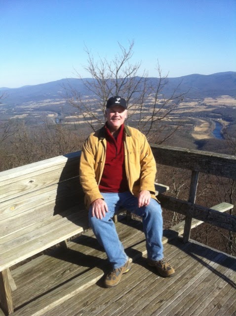
Near the top, there were traces of a fire from the summer – I’ve done some follow-up research on this and will have a post tomorrow. And then you reach the summit with the observation platform and those views; here’s photo here of me up there.

The AOA team maintains a solid pace on these hikes, and we did the 9.2 miles in about 6 hours, about 1.5 miles an hour. That’s quicker than my usual team does these routes, we plan for a mile per hour. I think I learned a few things that will help us with the pace, which in turn will give us more planning flexibility for the summer hikes ahead.

I have wanted to do this hike a long time – Kennedy Peak simply dominates the Page Valley view, and so it’s been a destination for me since I started coming here. Now I’ve got it checked off (and the neighboring Duncan Knob, last photo), and I’m looking forward to getting a few more folks out there with me.

Thursday, October 7, 2010

Return to Seneca Rocks: an Easy Day Hike

A few weeks ago, the day after my hiking group did our day hike in Dolly Sods Wilderness, we made a stop at Seneca Rocks in West Virginia.  There's a blog post at http://hawksbillcabin.blogspot.com/2010/09/west-virginia-weekend-final-post.html.  On Saturday, I talked Mary into a drive over there after our farmers' market visit and brunch at Main Street Bakery.

The drive is between 90 minutes and two hours each way from Stanley, via H-burg and US 33.  It is scenic in parts, and the highway is a mountain road crossing Appalachian summits (all less than 4,000 feet) four or five times before you get to Seneca Rocks.  There are a couple of little tourist attractions, restaurants and such, at the base of the rocks, and there are also climbing schools here, which was pretty interesting to check out.

After we grabbed lunch, we went over to the park to check things out.  One of the reasons I wanted to come back here was that I wanted to take the foot path up to the observation platform, and I had learned during the last trip that it will close for reconstruction during October and be closed for up to a year - so time was of the essence.

This path climbs between 750 and 900 feet (the resources all state different altitudes for the path!) and is about three miles round trip.  So it is similar to many SNP day hikes in that regard; although the layout of this one, with switchbacks and steps, make it somewhat easier despite the steepness.  At the end there is an ample viewing platform (there were two parties of five on it when we got there) - and the trail is well travelled, very crowded while we were there mid afternoon.

I have a couple of photos, again of the rocks from the parking lot, of a view you catch of the stone ridge on the way up, the ridge at the top, and the stream that you cross twice from the visitor center before you get to the trailhead.  Apparently this is a popular trout stream, with trails alongside managed by WV Trout Unlimited, although that pesky invasive algae (I forget the name at the moment) is present here.

So there are two interesting observations from this hike.  That razorback ridge, so impressive from the ground, is only 10 to 20 feet wide - that's the first thing.  In the shot I took of it, you have the entire width of it in the frame (along with my hand, where I tried to shield the phone cam from the sun).  When we were at the platform, a lot of people were going on up to summit the left side of the rocks - I thought about this, but decided against it due to the sun's angle and the craggy footing.  Still, I might like to try this in the future.

The second thing was the disregard for signs posted along the trail to not take shortcuts between the switchbacks.  Despite them, we saw quite a few beople contributing to the erosion and damage on this trail by scooting off and climbing the hillside.  I was shocked to see that a group of Mennonite kids on an outing were even doing this, they are usually more respectful of the environment when I encounter them on outings in the SNP.

I've discussed this with NPS employees in the past, why you don't see so much of this in the Park.  The difference may be in the entry fees, that having paid a nominal fee to get in, you are reminded to take care of the resource...we see this closer in to Hawksbill Cabin, up on the nearby Storybook Trail in GWNF, where the local kids spray paint graffiti on the rocks.

The climbing schools were going full-tilt on our visit, there were a couple of dozen climbers making their way up the rocks on several routes.  And as we were leaving, with the angled golden sun lighting up the rocks, you could see a crowd up on the summit.

Wednesday, May 26, 2010

Hightop Mountain: An Easy Shenandoah National Park Day Hike

Sunday morning I had planned a hike up in Shenandoah National Park, thinking I’d go where ever the mood hit me to go using my Easy Day Hikes book as a guide. It turned out that I had left the book in Alexandria, so I referred to my “Hikes to Peaks and Vistas” book, from the Shenandoah National Park Association (quick link to the book: http://www.snpbooks.org/mm5/merchant.mvc?Screen=PROD&Store_Code=SNPBOOKS&Product_Code=P%26V&Category_Code=BK) and picked the Hightop Mountain Summit.


The short Heatwole guide description of this trail says it climbs about 935 feet and is about 3 miles round trip, following the Appalachian Trail the whole route. That makes it a bit steeper than Mary’s Rock, so I was expecting a workout. I guess the walking I’ve been doing lately, since my office moved downtown, is helping and this wasn’t so bad for me. The first two photos are of the trailhead sign and some large bolders near the start of the hike.

Besides the possibility of views on this hike, I was hoping to catch a view of some trilliums, since I knew as May advanced they were probably already past peak. There were quite a few wildflowers blooming, and I did find a few red trilliums scattered around ¾ of the way to the summit. I plan to post a few of the wildflowers I saw in a writeup tomorrow or Friday – I also have a “Tech-watch Geek” post coming.

Heatwole goes on to mention some history associated with this area of the Park, and the 3,585 foot summit of the mountain (the views are actually from ledges just below the summit):

“On March 18, 1669, the explorer John Lederer first reached the crest of the Blue Ridge. The ledge you’re standing on may be the point from which he first saw the Shenandoah Valley.”

When I started my hike, it was sunny at the trailhead, but I could see that low clouds were swirling partway up the mountain, obscuring the summit. So I knew the views might be limited from the top – and that’s what I found. However, I do like the experience of being up on the summit in the clouds, which these two photos show (click on them and they will open in a window for a larger view).

There is also a spring and an AT hut near here, so I walked the additional half mile or so to the spring. I looked around for a trail leading to the shelter but couldn’t find a trace of it, so I turned back and spent some more time enjoying the views into the clouds from the cliff.

I met two thru-hikers when I got back to the trailhead. I didn’t have anything to share with them, or I would have…they’d both been on the Trail for about 10 weeks. While they were close by each other in this stretch, they weren’t hiking together – I encountered them about 5 minutes apart while I was taking off my pack and putting away my hiking poles. I didn’t catch their trail names.

Tuesday, January 12, 2010

Local and Family-owned in Front Royal

Turns out, an old friend from Berlin lives in Front Royal (hi Mike!), which, at about 2/3 of the way to Hawksbill Cabin, is a landmark of the trip. This is mainly because it is the end of the freeway portion of the drive, and the beginning of a bucolic transition that starts with suburban Front Royal neighborhoods perched on bluffs along the Shenandoah River, and gradually winds through the widening valley, opening up to a view framed by the Blue Ridge and Massanutten Mountain, and filled with its farms and forests.

There’s a couple of things we especially like about Front Royal – of course, there is the little hamburger stand Spelunkers right there on our route ( http://www.spelunkerscustard.com/ ) . If we are on the short turnaround weekend plan, we’ll stop here for a Saturday lunch, or if I am on one of my Park adventures and enter at the north entrance, I’ll grab a bite here before going in. People tell me the custard is great – looking at the website, I realized I’ve never tried it!

Since we’ve been going out, another business opened along the road in Front Royal that I like to stop at whenever the schedule permits – Two Fat Butchers. ( http://www.twofatbutchers.com/ - and see the photo). For the most part, I just pick up sausages for grilling when I am in the store – I get most of my steaks and beef cuts from the Burners' Trio Farms in Luray whenever I can. But sausage is certainly not everything they have at this place…and frankly, I think it’s worth a drive out to Front Royal from DC all on its own.

First of all, there is a great story here. The first time I stopped in, with my friend Chris, we met one of the butchers and talked about some of their values as a family-owned business. The butchers have more than 26 years of experience combined, and work in the evenings to prepare the inventory (and dress the bountiful deer that the local hunters bring in during the season). Their wives and families work in the store during opening hours, making for a refreshingly traditional arrangement that adds heaps of quality to the experience.

After our first impromptu visit, Chris was inspired and made an order – he chose the “Six Pack Attack,” recently advertised at $166.66, and including: six pounds each of ground chuck, chicken, link sausage, pork bone in chops, and roast, and six premium ¾ inch cut steaks. That’s most of a winter freezer load for a couple. What made this purchase even more memorable is that he scheduled pick up on the Saturday night after we did our Duncan Knob climb (a three-part review starts here: http://hawksbillcabin.blogspot.com/2009/03/weekend-hike-duncan-knob.html ).
He was supposed to pick up the meat before they closed at 6 pm; but we were just summiting – see photo – at 4:30. So shortly after I took this shot he called them and talked about the problem – we were four miles from the cars at that point – and they offered that someone would wait for him to come by for his pick up. He got there around 7:30 I guess, but that also just goes to show what family-run business values are.
As I am writing this, I have the store flyer and am checking out the winter freezer filler specials – one is half of a beef (150-175 pounds) and the other half a hog. There are some great cuts available in these packages and they seem pretty reasonable priced at $800.00 for the beef and $149.99 for the hog. And here on the back of the flyer is the deer processing offering in two options – standard and premium. Last year they processed so many local deer they had to stop accepting them before the season ended.
Family owned businesses and locally produced foods. Definitely something else to like about the Shenandoah Valley!

Friday, November 20, 2009

G&H's AT Shake Down Hike - Part 3

Part 3 - Post-hike Report

After three days, completing a section hike of about 32 miles on the Appalachian Trail, Gary and Howard returned Tuesday night. From the main south bound AT route, Howard said they had made a few side trips to visit trail shelters, where they checked out the log books and signed in with their new “trail names,” which I won’t report here to protect their identities. As experienced hikers, they knew when they set out that anything could happen on the trail and they were ready to improvise if needed, but, as Howard says, “Everything went as close to plan as we could have hoped.”

As they shared their impressions of the route, I began to notice that their descriptions of the experience were similar to those I’ve read about in thru-hiking books such as “AWOL on the Appalachian Trail,” and “Bryson’s A Walk in the Woods.” One of the first things you notice on trail sections like the one they chose, is that even though the route follows a ridge and you wouldn’t expect major climbing, there is a cumulative effect from all the little “ups-and-downs” from short climbs and descents.

They took advantage of their freshness on the first day and did extra miles, so the second day was less difficult. Even so, the body rebels at the out-of-the-ordinary strain, stiffening at each break on the trail, or making it hard to get up in the morning. By the third day, they had begun to settle in to their pace, making the last day the easiest day on the trail for them.

When I asked them about what gear they found the handiest, they agreed that their water filters were the key items in the packs, with headlamps coming in second. Gary said that since the winter days are shorter, they often had to quicken their pace to reach the day’s designated camp site so they could set up before it was completely dark, which made the headlamps very important.

They had carried their water with them on this Spring’s overnight hike on the Massanutten Ridge, so the water filters allowed them to reduce some of the weight in their packs. Water was required for the dehydrated meals they carried – all samples from the selection in their stores – and they heated it on a Jet Boil stove. In fact, all of the gear they used on the hike is available at the stores.

Speaking of their stores, Appalachian Outdoor Adventures and Evergreen Outfitters, Gary and Howard have been planning to join forces for the last few months, and with this hiking adventure behind them, they are set to complete the merger by the end of the year. Gary said, “We had been sending customers back and forth to each other and now everything will be in one location,” so the merger is a natural progression. And both are looking forward to the opportunities to expand their services to potentially include guided hikes and tours.

Gary and Howard are planning overnighters in the Spring, but the next multi-day hike won’t be until next Summer or Fall. They choose routes in Shenandoah National Park along the AT but also adventure into the George Washington National Forest as well.

As for the north district AT section hike, it served as an excellent shakedown for longer hikes in the future, with the added benefit of being able to test out some of the gear they sell. The credibility factor is important in their business, and these hikes serve to build it. That’s going to be an important asset as they complete the merger and continue to serve their customers.

This is the final post of a 3-part series on Gary and Howards section hike of the AT. The previous posts were on Wednesday and Thursday, the 18th and 19th of November.

Thursday, November 19, 2009

G&H's AT Shake Down Hike - Part 2

Part 2 – The Gear and Preparation

Earlier this year, Gary and Howard took an overnight hike along Saw Tooth Ridge and Kennedy Peak in the GWNF, but they have been thinking of doing the full AT section in Shenandoah National Park for some time. So this Fall hike covering the northern portion of the SNP AT is a warm-up for the longer section hike, which they hope to complete next summer.

In the past, Gary has posted helpful lists of gear on the Appalachian Outdoor Adventures Facebook page (http://www.facebook.com/#/pages/Luray-VA/Appalachian-Outdoors-Adventures/97338336006?ref=mf), which I’ve referred to for hikes that require more than the usual preparation. So I asked Gary and Howard about their equipment preparation for this hike, and they described their choices of packs, tents and footwear.

For packs, Gary chose Osprey, while Howard used a North Face pack. Their tents were both North Face gear; footwear for Gary was from North Face, and Howard used a new pair of Vasque Breezes. They carry all of the gear they used on this AT section at both stores in Luray, and are planning to continue these lines after their merger next month.

Even the dogs are outfitted for the trip: Martha and Athena will be wearing Ruffwear dog backpacks, which Howard carries at Evergreen Outfitters. Lilly gets a break from carrying a pack – but even so, the dogs will probably do two to three times the amount of walking on this trips as the humans do – they may go as far as 90 miles while the humans walk 30 miles on the path!

Getting back to the motivation for this hike – Gary and Howard recognized that Page County is a hiking and camping destination for people from all over the world. The visitors aren’t just AT thru-hikers coming down into Luray for a “town day,” there are also people who come to sightsee at Luray Caverns or to visit the Shenandoah River. The pair wants to inspire local people to take advantage of the resources in the area. Gary keeps a list of their outings on the Facebook page – trips to GWNF and SNP are the most frequent destinations, and the SNP AT section thru-hike will be next year’s highlight.

We’ll conclude these posts with Part 3 tomorrow – featuring an "after-hike" update on the experience.

Wednesday, November 18, 2009

G&H's AT Shake Down Hike - Part 1


Part 1 – The Plan and Some Activities

Luray is getting a reputation as a great Appalachian Trail “Trail Town,” and with miles of hiking trails and plenty of camp sites available in nearby Shenandoah National Park and the George Washington National Forest, it’s an emerging backpacking, hiking, and camping destination. Gary Drum and Howard Thompson, owners of two outfitters stores in Luray, decided to set out for a Fall section hike of the Appalachian Trail this week.

Their stores, Appalachian Outdoor Adventures and Evergreen Outfitters, are planning to merge this Winter, but over the last couple of years the two have built a friendship on their shared enthusiasm for all of the outdoor activities this area has to offer. With the number of adventure-seeking tourists in Luray increasing every year, whether they are AT thru-hikers or families heading for SNP campgrounds, Howard and Gary set a goal to hike the entire length of the AT as it passes through the Park, starting with a 30-mile “shake down” hike of the northern section this month.

Joining Gary and Howard on the trip were Luray friends Garrett Johnson and Alan Jones, and three adventure dogs, Lilly, Martha and Athena. The group has done a couple of similar hikes together in the past, and made the “natural choice” to hike from Front Royal to Thornton Gap on the AT (it’s natural because “it’s there,” according to Howard. The group planned to hike about 10 miles per day over this section’s moderate terrain, from Sunday to Tuesday, spending one night camping back country and a second night in one of the campgrounds.

Besides the camping, the group had planned for other activities on the trail. Their families were tentatively planning to meet them on the trail one day, but the rendezvous was nixed due to scheduling conflicts. They are also planning to “taste test” some of the dehydrated entrees and breakfasts that they carry in the shops so that they can rate them and make recommendations to shoppers.

…tomorrow’s post will look at some of the gear Gary and Howard are using on the section hike.

Tuesday, October 6, 2009

Balckrock Summit: An easy Shenandoah National Park Day Hike


Depending on the guidebook you use, the Blackrock Summit trail, in the South District of Shenandoah National Park, is listed at 0.8 to 1.0 miles in length, with about 175 feet of altitude gain. The NPS Riprap Area Road and Trail Map highlights this trails “outstanding views and interesting geology,” and the Easy Day Hikes book (the image will take you to an Amazon.com page) estimates hiking time as up to one hour.

The trailhead starts from a parking lot at Skyline Drive mile 84.8, where there is a sign describing the trail and the geology of the mountain. From there, there is a gentle climb through a fern grove to a junction with the Appalachian Trail, and then a short distance further to the summit, at an altitude of 3,092 feet.

The trail skirts the boulder field and continues on through this gap in the rocks to a couple of the nearby mountains, which include Trayfoot Mountain at 3,374 feet and Furnace Mountain, at 2,657 feet. I read that there is an abandoned observation tower ruin on Trayfoot, only a half mile more distant, visible in the photo here. At first I set out for this – looking forward to the additional 300-foot climb and the added distance.
I ran into returning hiker who had gone to Furnace Mountain, making an overall hike of just over 4 miles. It was a beautiful day and it was clear they had enjoyed themselves – they recommended I continue on to that summit.
I had a late start, and since I don’t relish the thought of picking my way through a rock scramble in the dark, I decided to turn back once I reached the trail junction for the Trayfoot Summit. I headed back to Blackrock, contenting myself with the idea that the little rock scramble and views would probably be worth it.

When I got back to Blackrock, there were a couple of folks at the top of the scramble, including a young boy. He scampered down to my route up, and I asked him if he had seen any rattlesnakes. “Naw,” he said, “I’ve been up here three times before and I’ve never seen any.” “That’s good to hear,” I said, “I’ll take your word for it.” I could see his dad up above smiling at the young trail guide.
The source of the name Blackrock is this flaky black lichen that covers many of the stones on this summit. The lichen is in evidence at many similar features in the Park, such as along the Riprap Trail, on Old Rag, on the Mary’s Rock Trail, and in places at Dark Hollow Falls. I also saw it on Duncan Knob over on Massanutten Mountain. Here, it was mainly small growths, but in some of the other places it hangs in fleshy leaves from the rocks.

As far as my decision to turn back from the Trayfoot Mountain summit goes, one of the other hikers on Blackrock confirmed that I had made the right choice. “Never heard of an observation tower up there,” he said. “That hike is just a lot of extra work, for no reward.”

I was impressed with the beautiful day at hand and the incredible surprise of the environment at the summit, so I messaged a couple of the photos to Mary and others. The responses were unanimous, all remarking on Blackrock’s beautiful scenery. Mary wants to come back there with me, and we’ll do that soon – we also need to take on a similar hike in the Central District – Bearfence Mountain, which has a similar rock scramble.

Monday, September 14, 2009

A Week on Skyline Drive


Today I need to get back to work with a full agenda for the week, including preparation for an intercompany transfer, a road trip to Las Vegas next week for a speaking engagement, and all those delightful things that justify getting paid. Meanwhile, I also have a queue of blogposts that will be going up about discoveries last week in the Shenandoah Valley - I may not have accomplished everything I set out to do on the "staycation" - but I did get quite a few of them done.


After the preliminary kitchen upgrade work - deliveries and the dishwasher installation - was done on Tuesday, I was able to do five day hikes, averaging about 4 or 5 miles a day and 900 feet of climbing, all in Shenandoah National Park:


  • Calf Mountain (Southern District) - photo is from this one
  • Powell Gap (Southern District)
  • Jones Run Falls (Southern District)
  • Fox Hollow (Northern District)
  • Compton Peak (Northern District)
Three of these hikes were from the "Easy Day Hikes" book (link http://www.amazon.com/gp/product/0762734159?ie=UTF8&tag=hawkscabin-20&linkCode=as2&camp=1789&creative=390957&creativeASIN=0762734159 ) and the others were "freelanced," although the Compton Peak hike was the result of a recommendation from Ranger Mike at the Dickey Ridge Visitor Center.


For vacation reading, I completed Colin Fletcher's "The man Who Walked Through Time," (link http://www.amazon.com/gp/product/0679723064?ie=UTF8&tag=hawkscabin-20&linkCode=as2&camp=1789&creative=390957&creativeASIN=0679723064 )

and "Long Distance Hiking on the Appalachian Trail for the Older Adventurer" (link http://www.amazon.com/gp/product/0938631209?ie=UTF8&tag=hawkscabin-20&linkCode=as2&camp=1789&creative=390957&creativeASIN=0938631209 ) by David Ryan.


Both made for good recreational reading and a review will follow...

Of course, I had some time for socializing with friends in the Valley, special thanks to Howard on the tip to visit the Speakeasy (this is the pub at the remodeled Mimslyn Inn in Luray) on Thursday night - had a great evening out (and taught the bartender how to make a Ketel One dirty martini, up with two olives - and tested the results on Saturday night)...


Also, the farmers' market, a chat with Sally and Dan, cicadas, praying mantises, Jesse visiting to take a look at the work involved on the kitchen remodel...and a great walk through town with Mary on the Hawksbill Greenway on Sunday.

Of course, there is the sad note that Mary and I lost our beloved Gracie last week. So far, both of us find ourselves thinking about her a couple of times a day. I am still not ready to post on this; we had her for more than 14 years and there is a lot to sort through.


I am really looking forward to getting these hike reviews up, and will do so over the next two weeks. Meanwhile, ciao for now!

Friday, August 7, 2009

Updating the Heatwole "Guide to SNP"

If you follow the periodic hike reviews here on Hawksbill Cabin, you know that from time to time I’ll include a citation from the version of “Guide to Shenandoah National Park,” which was originally published in book form in 1978. I started using this guide in 2005, as Chris and I prepared for our Half Dome ascent and were looking for trails with scenery and elevation changes.

Henry Heatwole was the author, and maintained what I consider a fairly exhaustive guide to the blue-blazed trails until he passed away in 1989. According to Henry’s son, Tony (his address can be found on the index page of the web-guide), the predecessor organization to the Shenandoah National Park Association took over the management of the Guide in 1989, and has made minor revisions over the years. The on-line version is the result of updates through 1997.

As Tony notes in the introduction to the on-line Guide, “…almost every aspect of the Park is subject to change. For example, new trails are created from time to time, and others abandoned. Rules for visitor use will change to reflect changing conditions. The state of trail maintenance, vista clearing at the overlooks, and facilities available in winter, will depend on money and personnel available.”

It is the extra details in the Heatwole guide that make it special for me – from the inscription he noted on the abandoned Pocosin mission, quoted earlier this week, to other trail details that I’ve found there. However, many vistas that he described have become overgrown with the emerging forest in the Park, and other changes have come and gone, so the Guide is now due for an update.

When I sent Tony the link to my Pocosin Trail review, he shared some happy news – the association has decided to update the on-line Guide. I don’t have publication date details, but I’m looking forward to the updates to this valuable resource. The on-line Guide can be found at http://www.ajheatwole.com/guide .

Thursday, June 11, 2009

AT Thru Hikers Update

During some yard work on Sunday, Mary got stung by a wasp. I have some sting relief meds in my hiking first aid kit, so we took care the bite quickly.

I really like this stuff. It was a life saver on late summer hikes a few years ago when Chris and I were prepping for the Half Dome summit. Back then, he used to go down the trail first.
In the late summer, yellow jackets can often be found nesting in the ground or rotting wood near trails. It is not unusual that a first hiker will disturb a nest, and the following hikers walk unsuspectingly right into a cloud of angry insects. This is what tended to happen to me, and that is how I learned about the sting relief meds.

Since the ointment gave Mary instant relief, we decided to take a drive into Luray to see if Howard had any of the stuff sold alone or in small packs, so I could re-equip the first aid kit. He didn’t have the product I needed, but he had something else that is pretty good – Jewell Weed. Turns out Mary has some, but she left it at home.

We talked about how things are going in the store – big news coming at Evergreen Outfitters later this summer – and about the through hikers that are coming into town right now. Howard’s had thru-hiking visitors since late March, and I ran into one fellow, “Old Spice” in the store a few weeks ago.

Old Spice had stopped by to pick up a care package that was being delivered to the store one Saturday, but it hadn’t arrived yet. So he spent part of the day hanging out waiting for it around town, and I think he caught a movie, either Star Trek or Transformers. They kept his pack for him at the store, and the package arrived while he was hanging out. I was sorry I didn’t think fast enough to offer him a ride back up to the trailhead in the park.

Another thru hiker was hanging out in town this Saturday – she made her way around doing some errands. I heard that she was at the library, where she left the pack outside draped with a banner that said “I can’t believe I hiked all the way here from Georgia,” or something like that, as reported by Cindy, Howard’s mother-in-law.

Also in the store were three Dutch guys that were doing the trail, the “Three Stooges.” Here is a link to their blog about the trip http://www.bergopbergaf.nl/– it’s good reading. Howard said they had a good visit.

Back to the sting relief meds. Chris actually kicked up the bees on me twice back in those days, but luckily was right there with the meds both times after I’d gotten stung – this was always happening three or four miles into the hike, so it was a long way and very likely slow going back to the car for something.

These days, I go first on our hikes. Somehow, though, I don’t think it’s just about the bees. I think it’s because the young whipper snappers think I’m slow.

Monday, May 18, 2009

Signal Knob - A Moderate Day Hike


On Saturday, my new “hiking group” got together for a hike on Signal Knob, a mountain in the Massanutten Ridge that is near Front Royal. About two months ago we did the Duncan Knob hike together, so we decided to follow-up with this one, a little more rigorous and technical – a 10.5 mile trek with 2,500 feet of elevation change in two ascents, and two stream crossings.

Chris and I started out from the cabin, while Andy and Tom came down from the Leesburg area. The logistic challenge of meeting halfway came off without a hitch, as we arrived at the trailhead at exactly the same time! Here’s a photo of the group at the start of the hike.

The route we had chosen (from the Hiking Upward site) starts immediately with a 1,600 ascent over three miles, to the summit of Signal Knob. Following the summit, there are several peaks and a ridgeline walk in the route. We started in the sun, with temperatures around 80 and with a forecast of several thunderstorms possible.

We were only about 500 yards into the hike when we met a group of Koreans from a church group heading downhill fast. As they passed us, one of them told us there was a snake laying on the trail ahead. Well, I have my history with snakes now, thanks to encountering one in the cabin laundry room twice (check the "snakes" label), so we pressed on, and soon found a six-foot black rat snake sunning itself there on the trail. Hearing us approach, it quickly moved off and over the edge, disappearing into some brush.
Continuing upwards, we came across a group of 30 or so people, kids and adults, sitting around on some rocks and having lunch. Further along the trail we eventually ran into three more groups – two groups of scouts and one of some guys dressed in tie-die shirts, which we immediately dubbed the dead-heads. This was the most people I have seen on any of the Massanutten hikes. Other than these groups, which we encountered early in the hike, during the ascent – there was no one else on the trail.

Once you are most of the way up this first ascent, the view opens back to Fort Valley; this photo of me was taken there. We had stopped for lunch at this point, and needed to assess progress. The heat and the climb had made for a slow trek and we figured we were only three miles in on a 10.5 mile hike, so we were a little worried, given our past history of not getting off of the mountain until after dark.
I'm not saying we're slower than average. But maybe we are - the Hiking Upward site shows this as a 5.5 hour hike, and reading the reviews, on average it takes longer. So the fact that we found this a challenging trail is probably a typical experience.
Lunch out of the way, we got started again, heading for signal knob – which coincidentally, has a (television) signal tower on it, it turns out – shown here. In my post tomorrow, I’ll write about some of the technical aspects of the hike, and more of the views.

Wednesday, February 11, 2009

Woodstock Tower - part 2


One of the highlights of the Woodstock Tower is its view over the seven bends area of the Shenandoah River North Fork. This section of the river features a series of 180-degree direction changes, with resulting long fingers of land extending to the west or east.
Here are photos from the tower looking to the west, roughly scanning from south to north, showing this part of the River. Just to the south is the town of Woodstock, the county seat of Shenandoah County. Just over the ridge line shown here is West Virginia - with better clarity, you might see it in these photos.

A little history - Page County was carved out of Shenandoah County in 1812. Residents of what is now Page County complained to the Virginia Legislature about the multi-day trip from the east side of Massanutten to do state and county business. So Page County was formed (a small bite of Rockingham County was added to the Shenandoah County grant. Luray was formed as the County Seat of the new county.


To the east, the tower view looks back into Fort Valley, and Page County. Maasanutten Mountain is unique in that it has this valley inside of it - the mountain forms something of a ring, and the valley is a bowl inside of there. In the US west (where the mountains are much higher), they call these "basins" - but for some reason we don't call Fort Valley a basin.
That is the SNP ridgeline in the distance.


Tuesday, February 10, 2009

Woodstock Tower - a CCC Landmark

As I was drinking my coffee on Sunday morning, I was reviewing a few of my PATC Section maps. Although I wanted to check out the Massanutten and Tuscarora Trails, I started looking for a short hike we might take, this time over into the George Washington National Forest. I settled on the Woodstock Tower, a Civilian Conservation Corps edifice dating from the 1930's - this will be a two part post on our little trip.


To get to the Woodstock Tower from Luray, we drove up over the front ridge of Massanutten Mountain, then down into Fort Valley. Fort Valley is so named because George Washington apparently planned to fall back for a winter camp over there after Yorktown, but the war ended before that was necessary.

The road through the valley continues north past a couple of campgrounds, an all terrain vehicle trail, and other recreational facilities - not to mention some wonderful farms. We stopped briefly at Camp Roosevelt, which was the first CCC training camp. The gates were closed, but we were able to see some of the old foundations of the CCC buildings.


The tower is reached via a short, pink-blazed trail from a parking area for about 10 cars. The trail is only 1/2 mile long or so, and it has a gentle climb up the ridge to the tower. Total trail time might be 20 minutes if that. We encountered a couple of families coming down from the tower, so the rating on this would be "very easy."


These are photos of the sign marking the traihead, the stone steps on part of the trail, where there seems to be an abandoned fire road crossing. Finally, the tower itself...and the view from underneath the platform.
A "part 2" post on February 12 includes photos of the views from the platform.

Sunday, January 18, 2009

9-1-1 Bob on the AT

This weekend a friend of mine, let's give him a trail name of "9-1-1 Bob," checked out the blog. He sent an email after he read the post about the Awol on the Appalachian Trail book.


Bob was stationed with me in Berlin in the '80's, and like me he was a Russian Linguist. While our time in the USAF pretty much overlapped, he'd had a great tour in Crete before his arrival in Berlin. He now lives in Pensacola (I fondly remember a visit there where we went to a Greek diner and enjoyed incredible seafood). After reading the post, 9-1-1 Bob told me a story about an encounter with the AT back in the '70's.


Here's his story:


"...glanced atcher blog this morning. saw the bit about the app trail. in 1973 a buddy and i hitchhiked to the start in georgia and hiked it for a little more than a week. extremely nice."


I followed up, asking about the Georgia start, which I've heard is tough because you get into some difficult country right away.


"...the terrain wasn't too tuff, of course i was about 19 also. we ate different berries and puff ball mushrooms with our freeze dried food and drank out of springs w/out purification tabs.i remember we met a fella on the trail day hiking. for retirement his kids bought him a VW camper van. he was out on the trail with a canteen, knife, and camera. we went to his van for a shot of whiskey and a pack of real cigs (my buddy and i were rolling bugler or some such crap). i remember thinking that guy had it made. we stopped at a small rocky bluff at a stream to laundry and there were some city punks there. freaked em out: i'd raise my hand and extend a finger and butterflies would alight.we ran into a boy scout group one eve and they insisted we save our food and join them for dinner. even the people we caught rides with on the hitch back in that part of the world were extremely nice. young folks, old folks, just nice mountain folk. keep in mind we were both very longhaired college types at the time.i'm to the point that my idea of camping is the holiday inn, HBO, room service, and a heated pool.the pics of yer place and that whole area look quite nice and calming."

In the final exchange, I asked him if he'd made it out of Georgia.

"...we didn't. we weren't seasoned vets, but we didn't lollygag. then again, we had no agenda to be at such and such point by whatever date. one of the best times of my life.

"...i'm gonna check out that book, but i'm into about 6 right now so it will be a bit."

The original Awol on the Appalachian Trail post is here, and there is a link to the book on Amazon if other readers are interested: http://hawksbillcabin.blogspot.com/2009/01/book-review-awol-on-appalachian-trail.html

Wednesday, January 14, 2009

Hiking Prospects for the Winter

With all these posts on outside activities the last few days, readers may have wondered what I was coming around to...while nobody has told me they put more hiking down on their 2009 resolutions list, a couple of hiking compadres have mentioned they'd be interested in doing a few hikes this year.

So I've been thinking, and in my reading (Blue Ridge Outdoors magazine, specifically) I came across this two-day hike in the GW National Forest (excerpting from the description here):

The Massanutten Trail

Two-day hike: a 19-mile mini-loop that combines pieces of the Massanutten Trail with the Tuscarora Trail for a two-day highlight reel of the area.

Day One: Park at Signal Knob and head north on the orange-blazed trail, where you’ll climb to the Buzzard Rock overlook. After that, two miles of ridgeline hiking leads to views from Signal Knob, from which you can see Great North Mountain on the WV border. Signal Knob is 2,100 feet, the high point of this trek. Descent past the junction of the Tuscarora Trail into a small creek valley. For campers, look in the meadow near the creek. 8.5 miles.

Day Two: Follow the Massanutten Trail for a mile, intersecting again with the Tuscarora Trail. Take a right following blue blazes to the ridge to Three Top Mountain. Hiking 3.5 miles on the ridgeline via bolders and scrambles – with views of the Valley along the way. Continue following the blue blazes past another intersection, 5.5 miles to the day one parking area. 10 miles.

I'm going to check Hiking Upward and other resources on this route. We'll probably base out of the cabin for it, since we are so close to the route, and use car shuttling so we don't have to camp.

The route is outlined as a winter hike, but we are more likely to do this in March - may be slightly overlapping into the spring.

Tuesday, January 13, 2009

From the Outside Blog - best adventure sites

In a recent post on the Outside magazine blog, they reviewed the 100 best adventure web sites. I was curious – when I check out Backcountry.com and others, there is a strong west-of-the-Mississippi flavor, and while it’s beautiful country out there, we have boastful charm here in the mid-Atlantic as well.

So much for my own prejudices. This Outside post (link to the blog below) is organized by sections – travel, sports, adventure and environment, health, gear, weather, maps, widgets and friends, and phones – and is a one-stop review of a host of web-sites, rather than some adventure travel rating site.

I found the environment section pretty interesting, with citations of eco-news and commentary, sustainable business, and enviro-culture sites. These included grist.org, greenbiz.com, and thedailygreen.com. The inclusion of newwest.net does make the reference to the Rocky Mountain West, but including it among the others rounds out and softens the tendency to emphasize west over east.

The nutrition section has some pluses, too – eatwellguide.com has local sustainable food vendors by zip code (unfortunately HBBlogs own abowlofgood.com wasn't there - hopefully they'll keep up the good work and make it on this list someday!), and of course there is a link to livestrong.com (Lance is on the cover of the hardcopy magazine this month).

A final highlight for me are two sites I am going to take some time and explore further – breadcrumbz, a site that allows you to log a picture and gps route, and peakbaggers, which is a journal about summiting (I’ll start with Hawksbill and Stoneyman, of course, but I also did the Half Dome a few years ago…who knows, I may do Shasta or Washington someday!).

Here is a link to the Outside post: http://outside.away.com/outside/culture/200902/outside-guide-to-adventure-web-sites.html

Book Review: Awol on the Appalachian Trail

Lately I’ve turned to a few outdoor adventure stories, and this is the second I’ve recently read (a few weeks back I read "Into the Wild" and I recently read Bryson's "Walk in the Woods"). Like "Into the Wild," I picked this up at Evergreen Outfitters in Luray.

Thinking back on the experience of preparing for some longer day hikes I was especially curious about the motivation for a thru-hike, so I picked up Miller’s well-written book – it’s one of quite a few books and web journals out there but I’d rate it the best I’ve read on this topic so far.

He does a great job of describing the trail experience – the people he meets and the natural world the trail moves through; for example, how a community naturally forms around the annual class of thru-hikers as they make their way north or south, how one is always fairly close to civilization (they call it the “outside world” while they are on the trail) yet far enough away so that there could be real trouble with even a slight injury or other accident.

The jacket blurb says it is a book about “liberation, motivation, and perseverance;” that comes through in the telling. The book may help those thinking about taking on an AT thru-hike to make a decision about doing it. But, it was enough for me to read the story to know that section hiking is the way I’ll go…for now.

Tuesday, December 30, 2008

Looking ahead at 2009


On Saturday, Mary and I went up on Hawksbill Mountain - here's a snapshot from the summit.

It's the time of year where we think about change - what's next year going to be like; how am I going to be a better person, a better world citizen; things like that.

I've never been one to set down a list, but I usually have a general concept of things I want to try and do during the year - things I know I need to and want to prepare for, and some of them turn into plans, or work themselves out. So here are a couple of thoughts about that this year - hopefully I'll tread the thin line between trite and corny with this post!

In 2009, beginning with the inauguration and Obama's new presidency, we'll begin to see change and the reemergence of American leadership because of the new direction and reversal of some policies that have genuinely failed, and frankly, dishonored our great country. And sometime during the late summer or fall, we will emerge from this recession, already a year old and longer than average.

Between these two events, in the US, I think a larger transition will be shaped or even take place, and I hope it is one that impacts our lifestyles - moving us from net consumers to stewards, while allowing us to continue to prosper, and even grow - that'd be my hope.

For me professionally, this is my second year at AECOM, and it should be the breakthrough year if typical patterns hold. I already have a speaking engagement lined up in March, and a proposal for a paper was accepted for publication also in the spring. The company is still digesting about a dozen mergers from the last two or three years, creating what my friend Dennis calls an unfrozen moment. I want to create a practice that fosters collaboration with some similar work going on in offices in San Francisco, Denver, Roanoke, DC, and Alexandria. So the plan here is to press ahead, while things seem to be working (and there are at least two United routes in that group - maybe we'll accumulate the remaining miles for a European vacation while I am at it!).

Socially, I want to stay in touch with so many friends from the past that have come back in touch, especially my veterans group from Berlin. We can tell some bawdy stories and I revel in that, but each of us has grown to be real contributors to this great country in our own way. I'm proud of this, and look forward to celebrating a reunion with one or more of these friends this year.

I want to deliver better on my responsibilities as a husband and life partner to Mary and in our home - both here in Alexandria and at the Hawksbill Cabin. There's always some room for improvement in this department. And to my family, making the contributions I'm called to make along the way in a reliable way, with sound judgement.
Through this blog and any other medium I find that facilitates it, I am going to celebrate the community we've found in Luray. We've really come to appreciate our new friends there. There are at least four projects on my mind with the cabin (Mary has more, I am sure) - so that's another thing that will keep us coming back to that community.

Last one - I'd like to get more exercise. I'm talking with Chris about a two-day winter hike on the Massanutten Trail that recently was published in Blue Ridge Outdoors; and Henry is in touch about running the Big Sur 10K - out in Carmel, CA - in the fall. Both will take preparation and planning - and achieving either will mean I've gotten more exercise than I did in 2008.
So for the few readers who've made it this far...what are your plans for 2009? I welcome your comments!