Ramble On

Thursday, September 30, 2010

Clarendon Construction - September 2010, part 2

Since January 2008, more or less, I've been following construction progress on the buildings that are going up around my office in Clarendon.  The two main buildings I've been focused on are Clarendon Center, which has a south and north tower, and lately I've been watching what I call the "airspace" building that will use the site of nearby Clarendon Church while retaining architectural elements of the church itself.  We're up on the 8th floor here and have a great view of the construction sites, so I've pretty much been able to watch the entire process from demolition to build out.

Well, the big south tower of Clarendon Center is getting very close to completion.  I still see workers focused on a few exterior details, but most of the work has moved inside.  They have completed the sidewalks and planted street trees, and now they've moved a temporary office there to handle leasing out the residential part.  I have a photo of the building here, taken on a rainy morning last week - this will be my next to last post on this building, I'll dedicate an entry to it next month to close out my reporting on this one.


Meanwhile, work continues on the north tower.  It has some interesting points of its own - the builder committed to restoring the old storefront facades at street level on both the Wilson and Clarendon sides of the buildings, and these elements are finally between built.  Also, there are two towers on the east and west corners of the building that will add decorative elements; work goes on here on a one day per week pace.  So with this building there is a lot of progress to observe at this point, even though the majority of the structure is completed.

On the last of the three buildings, the airspace building at the church, site work continues.  They nearly have the hole cleared for the parking structure, and are working on shoring up the excavation.  The dewatering continues (you can see a couple of pumps in barrels at the front of the church).  They've installed some tiebacks (look for the orange paint along the wall at the back of the hole) into the soldier beams/lagging.  Look carefully to the left side of the excavation and you can see the drill rig that is used for the tiebacks. 

(Please note, Blogspot has changed the photo interface again and it's more difficult to position them now.  I think I've got these into positions where they are close to their associated text!)

Wednesday, September 29, 2010

The Pool's Closed

 
Mary and I decided to close the pool early this year, especially once we realized we would be taking our last swim on Labor Day weekend. Remembering that having the pool open as the leaves begin coming down makes the opening next year that much more difficult, we arranged to have the gang from Uncle D’s come out and take care of the closing mid-September.


So here’s a photo of the pool all closed down and covered up.

Not to be forgotten, I took late summer photo of the pool in all its glory before we closed it, so here are two from Labor Day weekend, just as we were deciding on the early closing.

Also, we learned something else about the pool during summer dinners on the brick terrace – that the ambient lighting it gives off is very pleasant. We used this as background light to supplement the candles during a couple of dinner parties with neighbors this summer. It made for a nice time.


The end of the bag garden

Mary still has tomatoes ripening in the Alexandria container garden – that’s not unusual for her, as she typically can continue harvesting until just before the first frost kills off the vines. Meanwhile my little experiment with bag gardening at the Hawksbill Cabin has ended – although we didn’t eat the zucchinis that came in (the backyard gopher did though, and the deer finally found the vines and ate the leaves off of the plants), I would call this a success.


Despite the skeptics (you know who you are!), the bag garden was a success because the bagged topsoil did keep the weeds away, and I didn’t see a single cucumber beetle on those plants, while the infestation in Alexandria was a natural spectacle. I saw a letter in the October/November 2010 Mother Earth News about another reader’s success with the approach, and I’d like to reprint an excerpt below:

"…This summer, our branch of the Adams Public Library attending our summer cooking class grow some of their own food, but most of these children had no access to a garden. Your article allowed us to think in a different direction. We planted four bags with green beans, cabbage, zucchini, radishes and lettuce.” The letter goes on to report that they didn’t have much success with the leaf vegetables or the radishes, but they did well with the beans and zucchini." - Rose Bryan, Geneva, Indiana

I imagine, just like in my case, the time for the summer bag garden has passed. In the photo above you can see the aftermath, where I turned the soil out of the bags and cleaned up the area. Now over the winter that topsoil will mix into the back yard. I am already thinking about whether or not to try it again next year – maybe with an earlier start, and maybe with a little fencing to keep the varmints out.

Tuesday, September 28, 2010

Rose River Falls, an Easy Shenandoah National Park Day Hike

With best intentions I headed up to Shenandoah National Park on Saturday. At first, I had hoped to do the “Three Falls” hike, a 10+ mile loop that passes Lewis Falls, Dark Hollow Falls, and Rose River Falls, and is described in detail on the Hiking Upward site. But I got a late start from Alexandria, and arrived at the Park too late for such an aggressive plan…so I decided to do the Rose River portion, which is a four-mile trek, described in the Heatwole guide.


The Park was jammed over the weekend, with overflow parking at every trailhead I passed. I was lucky and found a good space – on the lot, rather than on the shoulder – and I could see a couple of concrete markers just in the woods. So I quickly headed out after checking my map.

I found myself on a moderate descent on a rocky trail, just beginning to be covered with leaf litter. Everything seemed right, but I couldn’t reconcile where I was to the map…and a half mile in I realized I’d left my headlamp and first aid kit in the car. I like to keep these items in my pack nowadays, they give me a little more security when I am out on the trails alone – I don’t take a lot of risks, but these items help me feel prepared for the worst, like getting caught on the trail after dark.

The trail continued to descend, and the twists and turns looked like the Rose River Trail when I checked the map. But I was never sure, and decided I wouldn’t press my luck bushwhacking if I had to make a decision about where to go up ahead – instead, I’d simply call it a day and head back the way I came.

It is fall, and the flows are low in many of the streams in the Park. There was water in the canyon I was following, and at times I could hear gentle trickles moving unseen behind rocks, collecting in crystal clear pools where there might be cascades during wetter seasons. At the places where I found solitude, I did take a few quiet minutes to meditate to the sounds.

After about a mile and a quarter, and about 800 feet of descent, I stopped. Sitting on a rock near the stream bed, I couldn’t get the worries out of my head about the forgotten gear, and the possibility that I had misidentified the trail head. So I decided to head back to the car. I figure I was out on the trail for 2.5 hours, did about 800 feet in elevation change and around 2.5 miles total distance.

For scenery, this little hike was pleasant. It was steep, similar to the Dark Hollow Falls route, and the trail was narrow and rocky, so it was more difficult than that one.

On the climb, I passed a small party on the trail – with the leader of the group wearing bells, and before that, another group was talking about bears. Sometimes this means that a bear has been seen nearby. Sure enough, I saw a yearling running in the woods ahead of me near the top of the trail. He was in full gallop, probably having seen enough of all the human activity.

Monday, September 27, 2010

As seen on Skyline Drive: Wild Turkeys

This Saturday I took a little cruise on Skyline Drive to check out a new hike near Big Meadows.  On my way back, I encountered one of those little traffic jams that means some kind of wildlife has been spotted in the woods.  Maybe I'm a bit cynical about this now - the random stops on that road are quite dangerous, and most of the time people have stopped to look at a deer, so now that I've hit one and had a $2,000 car repair because of it I just don't appreciate the scenic wonder in the same way the rest of my (probably) Northern Virginia fellow travelers do.

However, what was crossing Skyline Drive the other night was out of the ordinary - a flock of about two dozen turkeys!  I've seen them in ones and twos before, but never so many at one time.  It was fascinating, and got me thinking about...well, white meat or dark meat - these hens were about as big as Canada geese.  I managed to snap off two quick photos, but one (the one I am not publishing, of course) didn't have a single bird in it...here you can see quite a few of them.

I remembered that I had a photo stored of a yearling cub I had seen back in June in nearly the same place, so I uploaded it and will share it now.  It's in the woods here foraging, probably only 30 feet or so from the roadway.

I saw one on my hike the other day, too.  It scampered across the trail 50 feet or so ahead of me - it saw and heard me coming, and it ran for a couple of hundred yards before it dissappeared into the woods.  By the way, my friend Evan took the time to put up a few posts about black bears on his blog - including how to increase your chances of seeing one, and suggestions for what to do if you do see one.  Click on this link and look for the posts on black bears:  http://wildlifeinphotography.com/species/.

Although the hike was good exercise, I had to break my attempt short.  More on that next post.

Friday, September 24, 2010

Clarendon Construction - September 2010, part 1

After I uploaded the photos today, I realized that I don't have any for the large building across the street from my office, nor do I have any of the air space building going up over the church nearby.  I'll take some shots over the next day and post them soon.

Meanwhile, the mid-block building is fast approaching completion.  It is slated for occupancy later this year, and it seems like they may be just a bit behind schedule. 

I am taking a "Construction Management 101" class right now at the local community college, and so the posts that I have on this topic will soon be part of my class project there, along with a site visit that I need to coordinate. 

Photos today include the first one, above, of the "tower" at the southern side of the mid-block building.  I took this one because it shows the windows on this side in the progress of being installed.  At the top you can just see the cupola, which will be a detail topic in my project - they used glass masonry up there, so I assume there will be some kind of lighting feature.

Also, a view of the construction elevator and the opening on that side of the building, allowing the equipment to be loaded in as the bulk of the work now continues inside.

A look back at the posts on this mid-block building reminded me that the old storefronts are to be reinstalled at street level on the north end of the building, along Wilson Boulevard, in the area that is black in the final picture.  That work has now begun; although these photos are two weeks old, some of the masonry is already going up in that area.

Thursday, September 23, 2010

The Cape Cod Lights

"A man may stand there and put all America behind him." Henry David Thoreau

On Sunday, we took a driving tour on the Cape, heading north from Chatham – ironically, taking this direction meant we were going “down the Cape.” A highlight of the afternoon was visits to two of three lighthouses we checked out during our trip; after seeing the Chatham Light on Saturday during a walk on the beach, we checked out the Nauset and Highland Lights further north on the Cape.


There are several others here, including one at Race Point at the far north tip of the Cape near Provincetown – we saw it from a distance but it is on accessible by walking, and some further west towards the mainland, or “up the Cape.” We may check them out on some future trip. The history of these lights is very interesting, and they’ve been an important part of New England navigation since the early 1800’s.

The first, Chatham Light, is still operating as a Coast Guard facility and is not open to the public, but it is close to a parking area and is one of a number of things that you can check out there at the Cape Cod National Seashore. This area was once guarded by two lights, which differentiated it from the Highland Light to the North…apparently they were mobile on skids so they could be aligned with the shifting openings of the barrier islands that guard the harbor.

The second light was decommissioned eventually, and moved to Nauset. We visited and actually climbed this light during Sunday’s outing – it’s the one in the photo that opens this post.

Besides the fact that it was originally in Chatham, this light has several points of interest associated with it: it is used as the logo for Cape Cod potato chips…I just learned that today from a scan of Wikipedia. For history, there were three lights here originally, again, to differentiate the location from Highland and Chatham, but you could see where this might get out of hand. So they decommissioned those “Three Sisters,” which were wooden towers, and moved one of the two Chatham Lights here instead.

The Three Sisters were moved to a little park nearby. It’s an easy walk from there to the current light – and you can park at the Three Sisters location for free, without having to pay an entry fee at the National Seashore area.

There is plenty of additional historical interest in this light – after it was decommissioned, it went into private hands along with the keeper’s house. The Wikipedia article on the light talks about how it was returned to the National Park Service and how it is open today, managed by a historical association.

The final light we visited was the Highland Light, in Truro. This light is still operated by the Coast Guard, although the facility is open to tours. It is also in the middle of the National Seashore area, so there are NPS facilities all around it, including a golf course that I would like to try at some point. Highland Light was authorized by George Washington himself and became the first light on the Massachusetts coast.

This light was the subject of an Edward Hopper painting, which was a point of interest for us, since Mary’s cousin Larry also frequently paints here at this part of the Cape. There’s a link to an image of the Hopper painting here: http://www.culture-making.com/post/highland_light_north_truro_massachusetts_by_edward_hopper

On a final note, the Nauset Light and the Highland Light are both in relocated locations. The eastern shore of the Cape is subject to the same coastal forces that affect Long Island, the New Jersey shore, the Outer Banks, and even Daytona Beach – a southward flow of the water constantly erodes the beaches and barrier islands. So these two lights have both been moved back from the cliffs along the shore to save them - in the photo to the left, the original location of the Highland Light is visible near the observation deck at the end of the path. One of the companies involved in both light moves was contracted for the big move of the Cape Hatteras light following its success with these two.

Wikipedia links to articles about the lights follow, along with another link to the NPS page about the National Seashore.

http://en.wikipedia.org/wiki/Chatham_Light

http://en.wikipedia.org/wiki/Nauset_Light

http://en.wikipedia.org/wiki/Cape_Cod_Highland_Light

http://www.nps.gov/caco/index.htm  

Wednesday, September 22, 2010

Cape Cod - Catching Up with Friends

One of the treats of traveling these days is that you can be really lucky and run into an old friend somewhere you’re off visiting – while we were on Cape Cod, we took the drive over to Hyannis to meet up with John and Lauren. My friendship with John dates back to Air Force language school in Monterey; they’ve settled in Falmouth, at the southwest corner of the Cape.


We met up late afternoon, so we were able to take in some sights from the Hyannis area before going to dinner. Starting with a cup of coffee in a nice bistro, we drove into town, where we took in some Kennedy memorabilia – this is where the famous compound and retreat is located, which we drove by while keeping a respectable distance.

Most of Hyannis reminds me of beach towns everywhere although there is something just a little different about it that I can’t quite put my finger on yet. We did steer clear of the areas closest to the highways, visiting Main Street, where among the highlights is the Cape Cod Baseball League’s Hall of Fame, which shares a building with the John F. Kennedy museum. Both of these were closed – they seem like they’d be worth a future visit.

We took a drive to the shore, where we strolled around a memorial park dedicated to President Kennedy. Lauren told us that the marina we could see from the park was the one Ted Kennedy often sailed from – that’s a quintessential Kennedy image for me, seeing the old main going out on his boat – so I enjoyed getting a look at this part of the country.

To cap off the sightseeing, we went to a little Hyannis joint called the Paddock. It’s a Cape Cod classic according to the web page (mind the volume if you click this - http://www.paddockcapecod.com/) .

We all enjoyed the “local special” which was a prix fixe style entrĂ©e, salad and dessert combination. I could rave on about my salmon, and Mary enjoyed the scallops…and everyone had the chowdah.

A blog note to say thanks to John and Lauren for showing us around – it was a great time. And it gives me pause to consider how lucky I was to serve with such a great bunch of people in the Air Force…the friendships seem to just get richer and richer as time passes on.

Tuesday, September 21, 2010

Cape Cod Weekend

Mary and I are just back from a weekend on Cape Cod, where we stayed at a charming little house in the town Chatham.  I'll have a few posts on our activities there - we visited with some old friends, took some walks on the beaches that make up the Cape Cod National Seashore, toured several of the lighthouses, and of course, ate seafood for nearly every meal.


Walking on the beaches, we found a variety of shells that we typically don't find in North Carolina or Florida, or even New Jersey, the beaches we most often visit.  Mostly, I'm referring to these scallop shells, arrayed at the bottom of the photo here. 


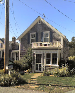
Of course, the opportunity to have seafood for every meal didn't escape us (although we passed on the calamari breakfast) - one of the nice finds was this little place in Chatham, called the Squire.  I really like the motto, thinking that we all should have one after reading this, although this one is taken.

Sam Adams O-fest on tap - I found it in most of our little stops.

Thursday, September 16, 2010

West Virginia Weekend - Final Post

On Sunday, I figured we’d be pretty tired from the hike in Dolly Sods. I thought there was a chance the guys would be up for a little bit of a hike after breakfast…but it was a small chance, so I also did some research on other attractions in the area, which is known as Canaan Valley. There’s a ski resort here, and a number of other natural features that are worth visiting.

The first one is Blackwater Falls, which is very close to the town of Davis, West Virginia. Since we were visiting in late summer, I figured the flows would be down, but it was still worthwhile for a visit.

The water is colored by tannins from the upstream evergreen forests, and the cascade tumbles over copper-colored sandstone to fall 62 feet into Blackwater Canyon. There is a rock abutment that divides the falls into two horizontal sections – we could see that during our visit, but apparently it’s more dramatic during times of higher water flow.

This is a state park, and they’ve built an extensive wooden staircase down to several viewpoints in the cabin. Not much of a leg stretcher on most days, but for us, it was enough to get the blood flowing.

We made a second stop after heading south out of the area, visiting Seneca Rocks. This formation is one of a series of what Wikipedia calls “razorback ridges” in West Virginia, and it is the furthest south on the ridge it occupies. In fact, this ridge borders the north fork of the Potomac River, which may place it in the western reaches of the original Fairfax land grant.

There is a great information center here operated by the Forest Service. I took the photo from the grounds, which also have this little monument to the 10th Mountain Division, which trained here before deploying to Europe, where they would fight in Italy.

Today the rocks are very popular with climbers, and there are a lot of mapped routes to the crest. At 900 feet tall, they are also easily reachable by a hiking trail to an observation point, but that is scheduled to close for maintenance in October, and may be closed through August 2011.

All in all, we had a great weekend out in West Virginia. Dolly Sods was every bit the great experience we expected it to be, and my hiking team is thinking of a repeat visit. Meanwhile, the other sights we were able to take in are worth another look as well. I may wait until next August for that, and take Mary out for the trip as well.

This is the last post for the week...we'll be back on Tuesday.

Wednesday, September 15, 2010

Dolly Sods Wilderness - a Moderate Day Hike, Part 3

For my final post on Dolly Sods, I’ll close out with a couple of photos of the varied landscapes we encountered. First, a note about the hike – it’s interesting to think that we might have been over-prepared for what we encountered, equipped with too much information, so that it colored our expectations. It was a challenging hike, at 10.5 miles longer than we might usually plan – but we didn’t get our boots sucked off of us in a mile-long bog, and we didn’t get lost on any of the trails…we didn’t even make a wrong turn in the wilderness, thanks to these cairns and the signs I posted on yesterday.

In fact, this series of cairns marks a trail intersection, a waypoint that we used to make a southward turn in our route. Later, we saw cairns that seemed to be randomly placed; maybe they were built where they were because somebody found some rocks, or because they were marking a favorite campsite, or because they were setting up some forgotten artillery target during the World War II training days…

The next shot here is of a view across a meadow that we had early in our hike. Looking at the rocks in the distance, I noticed that their color, texture, and shape was very similar to exposed rocks made of Tuscarora quartzite at a similar altitude in Shenandoah National Park and on Duncan Knob in GWNF. Here are links to past reviews of hikes to these destinations: Blackrock Summit - http://hawksbillcabin.blogspot.com/2009/11/third-blackrock-hike-in-sun.html, and Duncan Knob - http://hawksbillcabin.blogspot.com/2009/03/duncan-knob-summit-and-final.html.
Next shot, a meadow we encountered fairly late in the hike, about 7.5 miles in. On the northern part of the hike we did, we found ourselves frequently ducking into stands of trees – sometimes hardwoods, sometimes evergreens – and then emerging in a meadow like this, which might be a half mile across. Then after a slight descent or climb, we’d duck back into a stand of trees.

This final shot was taken in one of my favorite little meadows. This one was quite small, enclosed by evergreen stands. But it was overrun by these white flowers – any thoughts on what they are would be helpful. They were beautiful, and hopefully the photo gives an idea of how they glowed in the afternoon sunlight.

Tomorrow, I’ll add a final post about the trip to West Virginia, of some sightseeing we did on Sunday, a recovery day, as we planned to head back home in Northern Virginia.  That will be my last post this week due to some scheduling difficulties.

Tuesday, September 14, 2010

Dolly Sods Wilderness - a Moderate Day Hike, Part 2

For a second post, I wanted to take a look at the camp sites in Dolly Sods – at least in the areas we explored along Red Creek. As I mentioned yesterday, the original plan for this visit was for us to backpack in, camp overnight, and then backpack out.

We were approximately 1.5 miles into the hike, looking for a significant stream crossing, when I noticed a series of stepping stones set into Red Creek. Despite the change in direction, from heading west to heading north, we decided to explore the crossing anyway. It turned out to be a small island surrounded by a small split of Red Creek. The campsites on the island were quite elaborate and noteworthy.

For example, there is the one in the photo that opens this post. We nicknamed this one “the divan” because of its shape like a little couch before the fire pit. Here’s a picture of me sitting on one of the “sections.” There were other sites in this area, including one that Chris called the “French Bistro” because someone had put together a little table out of the red sandstone in the area.

Later as we continued on into the canyon, there were numerous great campsites – the Hiking Upward reviews actually state that these areas can be quite crowded, and it’s easy to understand why after you experience the natural beauty of the place and consider how lovely a summer evening beside this little stream could be. Here’s a photo of Chris at yet another of the camp sites in this area.

For the final campsite photo, here is one further downstream. Although we didn’t notice any major construction at this location, I did want to take the photograph to illustrate this food storage method – meant to keep their stuff out of reach of bears. I didn’t hear of any sightings in the park, but kudos to these guys for their precaution.

Monday, September 13, 2010

Dolly Sods Wilderness - a Moderate Day Hike, Part 1

Since an early hike this year, my hiking group has been itching to take on something more aggressive, and possibly to take on something more complex, such as a hike-in backpacking trek. We settled on Dolly Sods, which Tom had heard a lot about, and Chris, Andy and I quickly agreed. We began to think about the logistics involved, including the 3 to 4 hour drive out to West Virginia, the gear we’d need, and other issues.


Wikipedia describes the Dolly Sods Wilderness as a plateau, in fact the highest of its type east of the Mississippi, averaging between 3,500 and 3,800 feet above sea level. There are higher and lower areas, but where we were, this was the typical altitude. The plateau borders the eastern continental divide, so the creek we crossed – Red Creek – eventually makes its way to the Ohio River, the Mississippi, and then the Gulf of Mexico. Dolly Sods is in the Monogahela National Forest.

The Wikipedia article and many other reviews of hikes in this area describe a beautifully remote and challenging terrain (not to mention that unexploded ordnance from past military training is still periodically found here). They refer to the year-round boggy nature of the area, and warn that the trails are unblazed – so we prepared by getting familiar with additional equipment (toying with the idea of bringing a GPS in with us in fact, although we didn’t).

In the end, because of the dire reviews, but also because I haven’t yet bought a lot of the requisite equipment for overnighting (despite plenty of helpful advice from Howard and Gary at AOA), I asked Chris and Tom to reconsider the camping part. The team were good sports about it, and we ended up staying at the Canaan Valley Conference Center and Resort, which is actually a West Virginia state park. Andy wasn’t able to join us, so it was the three of us – Chris, Tom and me. We all arrived separately at the hotel by Friday night, and agreed to meet for breakfast (a buffet) at 7am or so on Saturday morning.

During the preparation, we’d agreed that we would try the Forks of Red Creek hike (link below from Hiking Upward, and first photo above is a shot from the stream crossing) because we were still talking about potentially camping, and this one offered the best proximity to many campsites. This turned out to be an excellent decision because of the wide range of scenery we passed through. Our 10+ mile hike ended up taking about 7 hours – just as the Hiking Upward review suggested; it was a first for us to finish with a similar time to what they specify on that site!

Possibly due to the long spell of dry weather, the bogs didn’t trouble us, although it was clear they could have been more difficult than they were. And there were enough signs, and the trails were worn enough, that we didn’t have a problem with orienteering.

Even so, I kept my Pathfinder alternating between the compass function and the altimeter function for this trip – moving onto that next step of using it as a tool. The compass function proved useful several times as we reached forks in the trails – keeping us from heading off on long detours or worse, dead ends.

I’ll continue this review tomorrow – with some photos of a little side excursion we did, and more photos of the trails. The Hiking Upward reference is below.

http://www.hikingupward.com/MNF/ForksRedCreek/

Friday, September 10, 2010

More on smokin' meat

As far as a follow-up post about my new smoker goes, I want to start out by saying thanks to my friend Chris, who actually did the bulk of the assembly of my new smoker. I would have gotten to this…but once he saw the job needed doing he was totally into it. Thanks bud!


One of the things about blogging is, you never know when a post is going to strike the chord and engage the readers to comment. I thought this might be the case with a post about bbq, like the one I put up yesterday about making brisket – and I was right. Once that post streamed over to Facebook, there was a nice dialog with comments and suggestions.

The first thing that came to mind as I started seeing the posts was a picture that I had in my head from Labor Day morning as Mary and I set out for breakfast. In the Kite Hollow area of Stanley, a fellow was sitting on the folded down tailgate of his F150, watching intently the barrel shaped smoker grill about 15 feet in front of him.

As we passed, I saw that he had just lit his coals, and was waiting for them to be ready – I guess this was about 9am. This whole thing is a bit like Thanksgiving in the end: the cooking is a big production, and in the end, however things turn out, the food is the centerpiece of a good time in the company of friends and family.

So now, let’s turn to some of the comments coming in.

From my friend Kelly, she mentioned an article about brisket that had appeared in the Washington Post recently. The dish wasn’t prepared as bbq, but the article is one of several that have come out recently about this cut of meat. Maybe it’s a change of season thing.

From Henry – the Labor Day ribs and chix photo that accompanies the post is his – he told me about how he likes using the trash can smoker he made. He sent a link, and this looks like an innovative, somewhat easy way to go if I take the next step with this and need a bigger set up. Actually a web search will yield a lot of interesting stuff about this cooking method, including tons of YouTube videos and other how-to’s…I have the spare mini-Weber I can adapt for this.

From Wes, there were some suggestions about technique and types of wood smoke to use:

“I recommend Mesquite wood for brisket, smoking it at 200-225 degrees about 1-1.5 hours per pound... low and slow will make the meat tender. Leave the fat on the top.. I cook it in a tin pan which will catch the drippings and keep the meat moist. I have used both marinades and dry rubs with good results. Try the BBQ Forum http://www.thebbqforum.com/  for some great info and recipes.”

When I told him that I wanted to emphasize hickory, since it is growing on the property, he replied, “Hickory is great for pork, chicken and turkey. When you do the pork loin, try mixing the hickory with the apple and oak if you can get it. Put a good pork rub on it the night before and smoke it to 160 degrees...it will dry out if you get it much hotter. You can usually get a bag of Mesquite chunks at Home Depot or Walmart for about $5.”

Then by email last night, a note from Bill in Tampa, who’s going to be in town next week. He wrote, “…saw your blog entry that you are doing some barbecuing; we'll have to discuss this and talk technique next week. I got a Big Green Egg several years ago and have enjoyed it very much. I have done several briskets, I always have liked the flavor but wish it was a little less dry. I have white oak, red oak, hickory, pecan, orange tree and Jack Daniels barrels to smoke with and they all have such great flavor. It is very cool that you have access to hickory and apple trees.”

I should mention that we also have white oak on the property, too.  I've got red oak in Alexandria - there are always branches and trunks coming down so it should be easy to come by.  So I have apple, hickory, and red and white oak to work with.  That makes a lot of opportunity to experiment with methods and flavors...Something to look forward to.

Thursday, September 9, 2010

Try the Brisket

After assembling and curing my smokin' new grill on Saturday, on Sunday I finally set out to bbq a brisket.  I'd picked up a small one a few weeks back from my friends at Skyline Premium Meats ( http://www.skylinepremiummeats.com/ ) (hey gang!)...at 2.5 pounds it is much smaller than what you might typically find for this cut, and it had been trimmed down to square as opposed to the typical tongue shape.

To prepare it, I rubbed it with olive oil, seasoned with fresh ground sea salt and black pepper, and then slathered on fresh garlic.  Then I let it sit on the counter to come up to room temperature while I went out to fire up the grill.

I built my fire in the box you see here to the left side, using match-light fuel to start things up.  After these coals were ready, I started dropping in hickory coals (the source of the very fragrant - and flavorful - blue smoke you see in the photo), which I did for the remainder of my cooking time.  I kept the heat in the main chamber between 250 and 300 degrees for the duration of cooking.

I had trouble with two things on this first attempt, but despite the challenges we both liked the brisket.  Maintaining the temperature consistently was difficult, so I'll keep working on that. 

I also used a meat thermometer to monitor doneness of the brisket.  It never showed read "medium rare" even, so I ended up over cooking by a bit.  Most of this brisket was in the medium well category, although the center thick areas were medium.  It definitely didn't need the 3.5 hours I gave it, maybe I'll cut back to 2.5 with a cut this size in the future.

The hickory smoke is the thing though.  I made some NY Strips a few weeks ago with these coals and they came out really fine.  The brisket picked up that distinguishing red layer around the edges, which we've come to recognize as a sign of the smoking technique.

And since we have three large hickories on the property, I'm hoping that I can learn to distinguish fallen branches well enough to save them for future cooking, like my neighbor Dan does.  I'll need to get some pointers from him.

I've also saved three foot long cuttings from some fallen apple branches, and I'll probably do a pork loin in the near future with apple smoke.

I've also dedicated a section of the garage to storage of my grills.  I only use charcoal out in the country - propane in Alexandria - but in three years I've accumulated three grills.

When it's just Mary and me, the mini Weber suffices - although I usually don't do smoked meats on that one.  For larger meals with lots of sides (in the height of summer, we have a lot of vegetables on the table) or where we're having the neighbors over, I'll use the Kingsford kettle.  And now, joining them, is the mini-smoker.

You know, we have to have our toys.  And this is something I"m definitely enjoying learning - I'll work on perfecting the technique and expanding the repertoire, posting periodically.